Current traffic around Gelli gaer
The following traffic incidents and congestion for Gelli gaer have been reported by Highways England, Traffic Scotland, Traffic Wales or Transport for London (TfL) in the last two hours:
RESOLVEN TO ABERDULAIS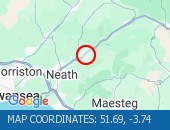 Description: A465NorthboundResolven to AberdulaisResurfacing workRoad closedDiversions in place13/07/26-12/08/26 2000-0600 :, Start time: 13/07/2026 20:00 , End Date: 12/08/2026 6:00, Severity: Road closure, Source: Welsh Government, Last updated: 13/07/2026 20:00
Nearest town: 4.87 miles from Gelli gaer.ABERDULAIS TO RESOLVENDescription: A465Both directionsAberdulais to ResolvenResurfacing workRoad closedDiversions in place27/07/26-26/08/26 2000-0600 :, Start time: 27/07/2026 20:00 , End Date: 26/08/2026 6:00, Severity: Road closure, Source: Welsh Government, Last updated: 27/07/2026 20:00
Nearest town: 4.87 miles from Gelli gaer.ROAD CLOSED: CLOSED; ROADWORKS Closed; Roadworks
Nearest town: 6.8 miles from Gelli gaer.
Nearest town: 4.87 miles from Gelli gaer.
Nearest town: 4.87 miles from Gelli gaer.
Nearest town: 6.8 miles from Gelli gaer.
There are no current incidents in this location.


 National Highways England
 Transport for London (TFL)
 Traffic Wales
 Traffic Scotland
 YOUR AD HERE