Traffic incidents
The following traffic incidents and congestion for M4 have been reported by Highways England, Traffic Scotland, Traffic Wales or Transport for London (TfL) in the last two hours:
J24 COLDRA TO J26 MALPAS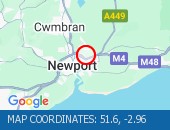 Description: M4WestboundJ24 (Newport) Coldra to J26 (Newport) MalpasCongestion :,Start time: 16/09/2026 17:17 ,Expected end time:16/09/2026 19:17,Severity: Moderate,Source: Welsh Government,Last updated: 16/09/2026 17:17
Nearest town: 1.17m from Caerleon. CLEARED @ 17:42J32 CORYTON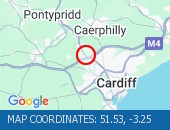 Description: M4SouthboundJ32 (Cardiff) CorytonResurfacing workOffslip closedDiversions in place17/09/26-18/09/26 2000-0600 :,Start time: 17/09/2026 20:00 ,End Date:18/09/2026 6:00,Severity: Road closure,Source: Welsh Government, Last updated: 03/09/2026 16:25
Nearest town: 1.51m from Llandaff. CLEARED @ 17:42J32 CORYTONDescription: M4EastboundJ32 (Cardiff) CorytonResurfacing workEntry slip road closedDiversions in place17/09/26-18/09/26 2000-0600 :,Start time: 17/09/2026 20:00 ,End Date:18/09/2026 6:00,Severity: Road closure,Source: Welsh Government, Last updated: 03/09/2026 16:24
Nearest town: 1.51m from Llandaff. CLEARED @ 17:42J48 HENDY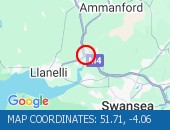 Description: M4WestboundJ48 (Pontarddulais) Hendy17/09/26-18/09/26 1900-0600Carriageway maintenanceExit slip road closedDiversions in place :,Start time: 17/09/2026 19:00 ,End Date:18/09/2026 6:00,Severity: Road closure,Source: Welsh Government, Last updated: 12/09/2026 10:38
Nearest town: 0.44m from Hendy. CLEARED @ 17:42J48 HENDY TO J47 PENLLERGAER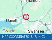 Description: M4EastboundJ48 (Pontarddulais) Hendy to J47 (Swansea) Penllergaer15/09/26-17/09/26 2000-0600Carriageway maintenanceClosedDiversions in place :,Start time: 15/09/2026 20:00 ,End Date:17/09/2026 6:00,Severity: Road closure,Source: Welsh Government, Last updated: 15/09/2026 20:00
Nearest town: 0.89m from Grovesend. CLEARED @ 17:42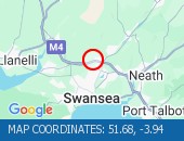 Description: M4EastboundJ46 (Swansea) Llangyfelach to J45 (Swansea) Ynysforgan17/09/26-18/09/26 1900-0100Carriageway maintenanceClosedDiversions in place :,Start time: 17/09/2026 19:00 ,End Date:18/09/2026 1:00,Severity: Road closure,Source: Welsh Government, Last updated: 12/09/2026 10:15
Nearest town: 1.63m from Clydach. CLEARED @ 17:42J44 LON LAS TO J45 YNYSFORGAN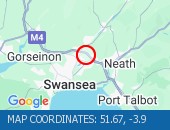 Description: M4WestboundJ44 (Swansea) Lon Las to J45 (Swansea) Ynysforgan16/09/26-17/09/26 1900-0100Carriageway maintenanceClosedDiversions in place :,Start time: 16/09/2026 19:00 ,End Date:17/09/2026 1:00,Severity: Road closure,Source: Welsh Government, Last updated: 12/09/2026 9:50
Nearest town: 0.66m from Clydach. CLEARED @ 17:42J39 GROES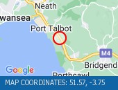 Description: M4WestboundJ39 Groes15/09/26-19/09/26 2000-0600Entry slip road closedDiversions in place :,Start time: 15/09/2026 20:00 ,End Date:19/09/2026 6:00,Severity: Road closure,Source: Welsh Government, Last updated: 15/09/2026 20:00
Nearest town: 0.58m from Margam. CLEARED @ 17:42J35 PENCOED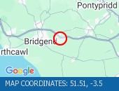 Description: M4EastboundJ35 (Pen-coed) Pencoed15/09/26-09/10/26 1900-0600Clearance workExit slip road closedDiversions in place :,Start time: 15/09/2026 19:00 ,End Date:09/10/2026 6:00,Severity: Road closure,Source: Welsh Government, Last updated: 15/09/2026 19:00
Nearest town: 1.94m from Llangan. CLEARED @ 17:42J34 MISKIN TO J38 MARGAM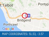 Description: M4WestboundJ34 (Llantrisant) Miskin to J38 (Port Talbot) Margam14/09/26-19/09/26 2000-0600SurveysEntry slip road closedDiversions in place :,Start time: 14/09/2026 20:00 ,End Date:19/09/2026 6:00,Severity: Road closure,Source: Welsh Government, Last updated: 14/09/2026 20:00
Nearest town: 1.91m from Bridgend. CLEARED @ 17:42J23A MAGOR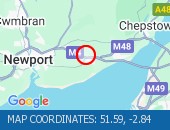 Description: M4EastboundJ23A (Magor) Magor17/09/26-18/09/26 2000-0600Clearance workOffslip closedDiversions in place :,Start time: 17/09/2026 20:00 ,End Date:18/09/2026 6:00,Severity: Road closure,Source: Welsh Government, Last updated: 12/09/2026 8:37
Nearest town: 0.64m from Magor. CLEARED @ 17:42Description: M4SouthboundJ32 (Cardiff) CorytonResurfacing workOnslip closedDiversions in place22/09/26-23/09/26 2000-0600 :,Start time: 22/09/2026 20:00 ,End Date:23/09/2026 6:00,Severity: Road closure,Source: Welsh Government, Last updated: 03/09/2026 16:27
Nearest town: 1.51m from Llandaff. CLEARED @ 17:42J38 MARGAM TO J42 EARLSWOOD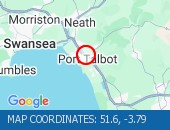 Description: M4Both directionsJ38 (Port Talbot) Margam to J42 (Swansea) EarlswoodResurfacing workRoad closedDiversions in place20/09/26-25/09/26 2000-0600 :,Start time: 20/09/2026 20:00 ,End Date:25/09/2026 6:00,Severity: Road closure,Source: Welsh Government, Last updated: 15/09/2026 18:14
Nearest town: 0.22m from Port Talbot. CLEARED @ 17:42J38 MARGAM TO J37 PYLE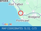 Description: M4EastboundJ38 (Port Talbot) Margam to J37 (Porthcawl) Pyle19/09/26-26/09/26 2000-0600J38: Entry slip road closed2 lanes closedSurveysDiversions in place :,Start time: 19/09/2026 20:00 ,End Date:26/09/2026 6:00,Severity: Road closure,Source: Welsh Government, Last updated: 12/09/2026 9:39
Nearest town: 1.25m from Kenfig. CLEARED @ 17:42J37 PYLE TO J33 CAPEL LLANILLTERNDescription: M4EastboundJ37 (Porthcawl) Pyle to J33 (Cardiff) Capel Llanilltern19/09/26-26/09/26 2000-0600SurveysEntry slip road closed1 lane closedDiversions in place :,Start time: 19/09/2026 20:00 ,End Date:26/09/2026 6:00,Severity: Road closure,Source: Welsh Government, Last updated: 12/09/2026 9:31
Nearest town: 1.94m from Llangan. CLEARED @ 17:42J23 ROGIET TO J22 PILNING/PRINCE OF WALES BRIDGE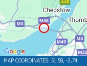 Description: M4EastboundJ23 (Chepstow) Rogiet to J22 (Avonmouth) Pilning/Prince of Wales Bridge19/09/26-21/09/26 2100-0600Maintenance workClosedDiversions in place :,Start time: 19/09/2026 21:00 ,End Date:21/09/2026 6:00,Severity: Road closure,Source: Welsh Government, Last updated: 12/09/2026 8:13
Nearest town: 0.81m from Portskewett. CLEARED @ 17:42
Nearest town: 1.17m from Caerleon. CLEARED @ 17:42
Nearest town: 1.51m from Llandaff. CLEARED @ 17:42
Nearest town: 1.51m from Llandaff. CLEARED @ 17:42
Nearest town: 0.44m from Hendy. CLEARED @ 17:42
Nearest town: 0.89m from Grovesend. CLEARED @ 17:42
J46 LLANGYFELACH TO J45 YNYSFORGAN
Nearest town: 1.63m from Clydach. CLEARED @ 17:42
Nearest town: 0.66m from Clydach. CLEARED @ 17:42
Nearest town: 0.58m from Margam. CLEARED @ 17:42
Nearest town: 1.94m from Llangan. CLEARED @ 17:42
Nearest town: 1.91m from Bridgend. CLEARED @ 17:42
Nearest town: 0.64m from Magor. CLEARED @ 17:42
J32 CORYTON
Nearest town: 1.51m from Llandaff. CLEARED @ 17:42
Nearest town: 0.22m from Port Talbot. CLEARED @ 17:42
Nearest town: 1.25m from Kenfig. CLEARED @ 17:42
Nearest town: 1.94m from Llangan. CLEARED @ 17:42
Nearest town: 0.81m from Portskewett. CLEARED @ 17:42
There are no current incidents in this location.


 National Highways England
 Transport for London (TFL)
 Traffic Wales
 Traffic Scotland
 YOUR AD HERE