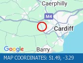
Description: A4232 : Now clear : Northbound : A48 Interchange to M4 J33 Capel Llanilltern, Start time: 15/05/2025 9:24 , Expected end time: 15/05/2025 9:29, Severity: Moderate, Source: Welsh Government, Last updated: 15/05/2025 9:24
Nearest town: 16.33 miles from Manmoel.

Description: A48M : Now clear : Westbound : J29 Castleton to J29A St Mellons, Start time: 15/05/2025 9:24 , Expected end time: 15/05/2025 9:29, Severity: Moderate, Source: Welsh Government, Last updated: 15/05/2025 9:24
Nearest town: 13.17 miles from Manmoel.

Description: M4 : Now clear : Eastbound : J28 (Newport) Tredegar Park to J24 (Newport) Coldra, Start time: 15/05/2025 9:14 , Expected end time: 15/05/2025 9:19, Severity: Moderate, Source: Welsh Government, Last updated: 15/05/2025 9:14
Nearest town: 11.95 miles from Manmoel.

Description: M4 : Now clear : Eastbound : J33 (Cardiff) Capel Llanilltern, Start time: 15/05/2025 8:46 , Expected end time: 15/05/2025 8:51, Severity: Moderate, Source: Welsh Government, Last updated: 15/05/2025 8:46
Nearest town: 15.38 miles from Manmoel.

Disgrifiad: A470 : Wedi clirio : Tuar Gogledd : Nantgarw, Amser y digwyddiad: 15/05/2025 9:27 , Amser gorffen a ragwelir: 15/05/2025 9:32, Difrifoldeb: Cymedrol, Ffynhonnell: Llywodraeth Cymru, Diweddarwyd ddiwethaf: 15/05/2025 9:27
Nearest town: 11.25 miles from Manmoel.

Description: A479 : Now open : Both directions : Bronllys to Tretower : Incident : Road closed : Fallen tree : Local diversions in place, Start time: 15/05/2025 8:32 , Expected end time: 15/05/2025 8:37, Severity: Road closure, Source: Welsh Government, Last updated: 15/05/2025 8:32
Nearest town: 15.93 miles from Manmoel.