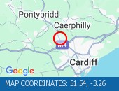
Description: A470 : Southbound : Nantgarw to Coryton : Congestion : Delays possible :, Start time: 20/03/2026 7:26 , Expected end time: 20/03/2026 9:26, Severity: Moderate, Source: Welsh Government, Last updated: 20/03/2026 7:26
Nearest town: 0.44m from Flynnon Taf.
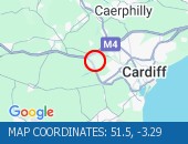
Description: A4232 : Northbound : St Fagans to M4 J33 Capel Llanilltern : Congestion : Delays possible :, Start time: 20/03/2026 7:33 , Expected end time: 20/03/2026 9:32, Severity: Moderate, Source: Welsh Government, Last updated: 20/03/2026 7:33
Nearest town: 1.36m from Peterston.
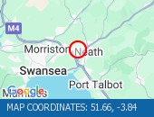
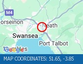
Description: A465 : Westbound : Neath to Llandarcy : Congestion : Delays possible :, Start time: 20/03/2026 7:34 , Expected end time: 20/03/2026 11:34, Severity: Moderate, Source: Welsh Government, Last updated: 20/03/2026 7:34
Nearest town: 0.77m from Llandarcy.
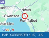
Description: M4 : Eastbound : J42 (Swansea) Earlswood to J41 (Port Talbot) Pentyla/Baglan : Roadworks : Road closed : 16/03/26-22/03/26 2000-0600 : Diversions in place :, Start time: 16/03/2026 20:00 , End Date: 22/03/2026 6:00, Severity: Road closure, Source: Welsh Government, Last updated: 16/03/2026 20:00
Nearest town: 1.92m from Port Talbot.
Description: M4 : Eastbound : J43 (Neath) Llandarcy : Onslip closed : Roadworks : 16/03/26-22/03/26 2000-0600 :, Start time: 16/03/2026 20:00 , End Date: 22/03/2026 6:00, Severity: Road closure, Source: Welsh Government, Last updated: 16/03/2026 20:00
Nearest town: 0.02m from Llandarcy.
Description: M4 : Westbound : J26 (Newport) Malpas : Offslip closed : Maintenance work : 16/03/26-21/03/26 2000-0600 :, Start time: 16/03/2026 20:00 , End Date: 21/03/2026 6:00, Severity: Road closure, Source: Welsh Government, Last updated: 16/03/2026 20:00
Nearest town: 1.53m from Newport.
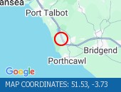
Description: M4 : Westbound : J37 (Porthcawl) Pyle to J39 Groes : Road closed : 16/03/26-21/03/26 2000-0600 : Diversions in place : Maintenance work :, Start time: 16/03/2026 20:00 , End Date: 21/03/2026 6:00, Severity: Road closure, Source: Welsh Government, Last updated: 16/03/2026 20:00
Nearest town: 1.55m from Kenfig.

Description: M4 : Eastbound : J38 (Port Talbot) Margam to J37 (Porthcawl) Pyle : Road closed : Maintenance work : 16/03/26-21/03/26 2000-0600 : Diversions in place :, Start time: 16/03/2026 20:00 , End Date: 21/03/2026 6:00, Severity: Road closure, Source: Welsh Government, Last updated: 16/03/2026 20:00
Nearest town: 1.25m from Kenfig.
Location: eastbound between the junctions with the M4 and the A4167 .
Lane Closures : Lane three is closed.
Due to: Roadworks.
Period : expect disruption until 18:00 on 10 April 2026.
Lanes Closed : There is one of three lanes closed.
Nearest town: 0.9m from Avonmouth.
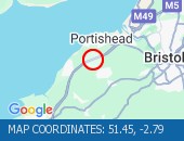
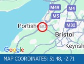
Location: northbound between junctions J20 (Nailsea) and J19 (Portishead) .
Lane Closures : Lanes 2 and 3 are closed.
Due to: Roadside Drains Works.
Period : expect disruption until 05:00 on 20 March 2026.
Lanes Closed : There are two of three lanes closed.
Nearest town: 5.72m from Avonmouth.
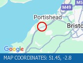
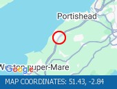
Location: northbound between junctions J20 (Nailsea) and J19 (Portishead) .
Lane Closures : Lanes 2 and 3 are closed.
Due to: Roadworks.
Period : expect disruption until 06:00 on 21 March 2026.
Lanes Closed : There are two of three lanes closed.
Nearest town: 5.67m from Congresbury.
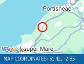
Location: northbound between junctions J20 (Nailsea) and J19 (Portishead) .
Lane Closures : Lanes 2, 3 and 4 are closed.
Due to: Roadworks.
Period : expect disruption until 06:00 on 21 March 2026.
Lanes Closed : There are three of four lanes closed.
Nearest town: 5.44m from Congresbury.
Location: northbound between junctions J24 (Bridgwater) and J23 (Highbridge) .
Lane Closures : Lanes 1 and 2 will be closed.
Due to: Road repairs are planned.
Status : Pending.
Schedule : From 20:00 on 20 March 2026 to 06:00 on 21 March 2026.
Lanes Closed : There will be two of three lanes closed.
Nearest town: 1.52m from Bridgewater.
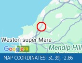
Location: northbound between junctions J21 (Weston super Mare) and J20 (Nailsea) .
Due to: Roadworks scheme is planned.
Status : Pending.
Schedule : From 21:00 on 20 March 2026 to 06:00 on 21 March 2026.
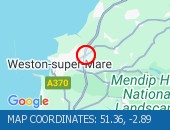
Nearest town: 3.29m from Weston-super-Mare.
Location: northbound between junctions J21 (Weston super Mare) and J20 (Nailsea) .
Lane Closures : Lanes 1 and 2 will be closed.
Due to: Roadworks are planned.
Status : Pending.
Schedule : From 21:00 on 20 March 2026 to 06:00 on 21 March 2026.
Lanes Closed : There will be two of three lanes closed.
Nearest town: 3.29m from Weston-super-Mare.
Location: northbound entry slip at junction J21 (Weston super Mare) .
Due to: Roadworks are planned.
Status : Pending.
Schedule : From 22:00 on 20 March 2026 to 06:00 on 21 March 2026.
Lanes Closed : All lanes will be closed.
Nearest town: 3.31m from Weston-super-Mare.
Location: eastbound between junctions J2 (Chepstow) and J1 (Avonmouth) .
Due to: Roadworks are planned.
Status : Pending.
Schedule : From 20:00 on 20 March 2026 to 06:00 on 23 March 2026.
Lanes Closed : All lanes will be closed.
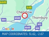
Nearest town: 1.24m from Chepstow.
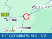
Location: southbound between junctions J26 (Wellington) and J27 (Barnstaple) .
Lane Closures : Lanes 2 and 3 are closed.
Due to: Horticultural works.
Period : expect disruption until 06:00 on 21 March 2026.
Lanes Closed : There are two of three lanes closed.
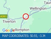
Nearest town: 8.61m from Bradford.
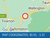
Location: southbound between junctions J27 (Barnstaple) and J28 (Cullompton) .
Due to: Horticultural works are planned.
Status : Pending.
Schedule : From 20:00 on 20 March 2026 to 06:00 on 21 March 2026.
Lanes Closed : All lanes will be closed.
Nearest town: 9.44m from Bradford.
Location: southbound at junction J27 (Barnstaple) .
Lane Closures : Lanes 1, 2 and 3 will be closed.
Due to: Horticultural works are planned.
Status : Pending.
Schedule : From 20:00 on 20 March 2026 to 06:00 on 21 March 2026.
Lanes Closed : All lanes will be closed.
Nearest town: 9.12m from Bradford.
Location: northbound between junctions J27 (Barnstaple) and J26 (Wellington) .
Lane Closures : The hard shoulder and lane 1 are closed.
Due to: Roadworks.
Period : expect disruption until 21:00 on 1 April 2026.
Lanes Closed : There is one of three lanes closed.
Nearest town: 7.72m from Bradford.
Location: northbound between junctions J21 (Weston super Mare) and J20 (Nailsea) .
Lane Closures : The hard shoulder, lanes 1 and 2 are closed.
Due to: Roadworks.
Period : expect disruption until 06:00 on 21 March 2026.
Lanes Closed : There are two of three lanes closed.
Nearest town: 3.14m from Congresbury.
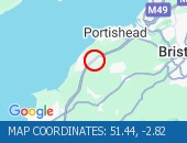
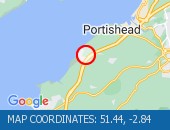
Location: northbound between junctions J20 (Nailsea) and J19 (Portishead) .
Due to: Roadworks scheme.
Period : from 20:09 on 16 March 2026 to 06:00 on 21 March 2026.
Nearest town: 5.45m from Congresbury.
Location: northbound between junctions J20 (Nailsea) and J19 (Portishead) .
Lane Closures : The hard shoulder is closed.
Due to: Barrier repairs.
Period : expect disruption until 17:00 on 20 March 2026.
Nearest town: 5.52m from Avonmouth.
Location: northbound between junctions J19 (Portishead) and J18 (Bristol) .
Lane Closures : Lanes 1, 2 and 3 will be closed.
Due to: Roadworks are planned.
Status : Pending.
Schedule : Expect disruption everyday between 21:00 and 06:00 from 23 March 2026 to 28 March 2026.
Schedule : From 21:00 on 30 March 2026 to 06:00 on 31 March 2026.
Lanes Closed : There will be three of four lanes closed.
Nearest town: 2.47m from Avonmouth.
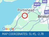
Location: northbound at junction J20 (Nailsea) .
Lane Closures : Lane one will be closed.
Due to: Emergency roadside drains works are planned.
Status : Pending.
Schedule : Expect disruption everyday between 20:00 and 04:00 from 20 March 2026 to 28 March 2026.
Schedule : From 20:00 on 28 March 2026 to 04:00 on 29 March 2026.
Schedule : Expect disruption everyday between 20:00 and 04:00 from 29 March 2026 to 1 April 2026.
Lanes Closed : There will be one of three lanes closed.
Nearest town: 4.83m from Congresbury.
Location: eastbound between junctions J2 (Chepstow) and J1 (Avonmouth) .
Lane Closures : Lane one will be closed.
Due to: Roadworks are planned.
Status : Pending.
Schedule : Expect disruption everyday between 20:00 and 06:00 from 26 March 2026 to 28 March 2026.
Lanes Closed : There will be one of two lanes closed.
Nearest town: 1.24m from Chepstow.
Location: eastbound between junctions J2 (Chepstow) and J1 (Avonmouth) .
Lane Closures : Lane one will be closed.
Due to: Roadworks are planned.
Status : Pending.
Schedule : From 09:00 on 27 March 2026 to 16:00 on 27 March 2026.
Lanes Closed : There will be one of two lanes closed.
Nearest town: 1.24m from Chepstow.
Location: northbound between junctions J19 (Portishead) and J18 (Bristol) .
Lane Closures : Lanes 1, 2 and 3 will be closed.
Due to: Roadworks are planned.
Status : Pending.
Schedule : From 19:00 on 20 March 2026 to 09:00 on 21 March 2026.
Schedule : From 19:00 on 21 March 2026 to 10:00 on 22 March 2026.
Lanes Closed : There will be three of four lanes closed.
Nearest town: 2.21m from Avonmouth.
Location: northbound at junction J19 (Portishead) .
Lane Closures : Lanes 1, 2 and 3 will be closed.
Due to: Roadworks are planned.
Status : Pending.
Schedule : From 19:00 on 20 March 2026 to 09:00 on 21 March 2026.
Schedule : From 19:00 on 21 March 2026 to 10:00 on 22 March 2026.
Lanes Closed : All lanes will be closed.
Nearest town: 2.47m from Avonmouth.
Location: southbound between junctions J19 (Portishead) and J20 (Nailsea) .
Lane Closures : The hard shoulder is closed.
Due to: Roadworks.
Period : expect disruption until 17:00 on 20 March 2026.
Nearest town: 5.48m from Avonmouth.
Location: southbound exit slip at junction J27 (Barnstaple) .
Lane Closures : Lane two will be closed.
Due to: Roadworks are planned.
Status : Pending.
Schedule : From 21:00 on 24 March 2026 to 06:00 on 25 March 2026.
Lanes Closed : There will be one of two lanes closed.
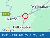
Nearest town: 9.15m from Bradford.
Location: northbound entry slip at junction J20 (Nailsea) .
Lane Closures : Lane one will be closed.
Due to: Road repairs are planned.
Status : Pending.
Schedule : From 21:00 on 23 March 2026 to 06:00 on 24 March 2026.
Lanes Closed : All lanes will be closed.
Nearest town: 4.88m from Congresbury.
Location: northbound between junctions J21 (Weston super Mare) and J20 (Nailsea) .
Lane Closures : Lanes 1 and 2 will be closed.
Due to: Road repairs are planned.
Status : Pending.
Schedule : From 21:00 on 23 March 2026 to 06:00 on 24 March 2026.
Lanes Closed : There will be two of three lanes closed.
Nearest town: 4.25m from Congresbury.
Location: northbound between junctions J20 (Nailsea) and J19 (Portishead) .
Lane Closures : Lanes 1 and 2 will be closed.
Due to: Road repairs are planned.
Status : Pending.
Schedule : From 21:00 on 23 March 2026 to 06:00 on 24 March 2026.
Lanes Closed : There will be two of four lanes closed.
Nearest town: 4.98m from Congresbury.
Location: westbound.
Due to: Roadside drains works are planned.
Status : Pending.
Schedule : From 21:00 on 23 March 2026 to 06:00 on 24 March 2026.
Lanes Closed : All lanes will be closed.
Nearest town: 0.58m from Avonmouth.
Location: southbound between junctions J20 (Nailsea) and J21 (Weston super Mare) .
Lane Closures : Lanes 1 and 2 will be closed.
Due to: Roadworks are planned.
Status : Pending.
Schedule : Expect disruption everyday between 20:00 and 06:00 from 23 March 2026 to 28 March 2026.
Lanes Closed : There will be two of three lanes closed.
Nearest town: 4.74m from Congresbury.
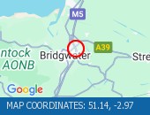
Location: northbound between junctions J25 (Taunton) and J24 (Bridgwater) .
Due to: Roadworks scheme is planned.
Status : Pending.
Schedule : From 20:00 on 23 March 2026 to 06:00 on 24 March 2026.
Nearest town: 2.34m from Bridgewater.
Location: northbound between junctions J25 (Taunton) and J24 (Bridgwater) .
Lane Closures : Lane one will be closed.
Due to: Roadworks are planned.
Status : Pending.
Schedule : From 20:00 on 23 March 2026 to 06:00 on 24 March 2026.
Lanes Closed : There will be one of three lanes closed.
Nearest town: 2.34m from Bridgewater.
Location: northbound exit slip at junction J24 (Bridgwater) .
Due to: Roadworks are planned.
Status : Pending.
Schedule : From 21:00 on 23 March 2026 to 06:00 on 24 March 2026.
Lanes Closed : All lanes will be closed.
Nearest town: 2.08m from Bridgewater.
Location: northbound between junctions J19 (Portishead) and J18 (Bristol) .
Lane Closures : Lanes 1, 2 and 3 will be closed.
Due to: Roadworks are planned.
Status : Pending.
Schedule : From 20:30 on 20 March 2026 to 08:00 on 21 March 2026.
Schedule : From 19:30 on 21 March 2026 to 09:00 on 22 March 2026.
Lanes Closed : There will be three of four lanes closed.
Nearest town: 2.21m from Avonmouth.
Location: northbound at junction J19 (Portishead) .
Lane Closures : Lanes 1, 2 and 3 will be closed.
Due to: Roadworks are planned.
Status : Pending.
Schedule : From 20:30 on 20 March 2026 to 08:00 on 21 March 2026.
Schedule : From 19:30 on 21 March 2026 to 09:00 on 22 March 2026.
Lanes Closed : All lanes will be closed.
Nearest town: 2.47m from Avonmouth.
Location: southbound between junctions J19 (Portishead) and J20 (Nailsea) .
Lane Closures : Lane one will be closed.
Due to: Roadworks are planned.
Status : Pending.
Schedule : From 20:00 on 20 March 2026 to 06:00 on 21 March 2026.
Schedule : Expect disruption everyday between 20:00 and 06:00 from 23 March 2026 to 28 March 2026.
Schedule : Expect disruption everyday between 20:00 and 06:00 from 30 March 2026 to 1 April 2026.
Lanes Closed : There will be one of three lanes closed.
Nearest town: 5.37m from Avonmouth.
Location: northbound at junction J19 (Portishead) .
Lane Closures : Lanes 1, 2 and 3 will be closed.
Due to: Roadworks are planned.
Status : Pending.
Schedule : Expect disruption everyday between 21:00 and 06:00 from 23 March 2026 to 28 March 2026.
Schedule : From 21:00 on 30 March 2026 to 06:00 on 31 March 2026.
Lanes Closed : All lanes will be closed.
Nearest town: 2.21m from Avonmouth.


 National Highways England
 Transport for London (TFL)
 Traffic Wales
 Traffic Scotland
 YOUR AD HERE