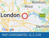
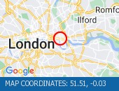
M25 Northbound - Accident×
 Accident
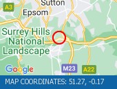
 Location : The M25 anticlockwise between junctions J8 (Reigate) and J7 (Gatwick) .
Lane Closures : Lanes 3 and 4 are closed.
Reason : Road traffic collision.
Status : Currently Active.
Time To Clear : The event is expected to clear between 11:00 and 11:15 on 28/04/2024.
Return To Normal : Normal traffic conditions are expected between 11:45 and 12:00 on 28/04/2024.
Lanes Closed : There are two of four lanes closed.
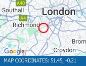
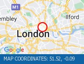
CLEARED @ 09:35Location:
M25, 2.96m of
Reigate,
Surrey
Street View M25 camera (Streetview):
Don't get stuck in traffic when you're out and about. Use our SMS service to get the latest traffic conditions instantly to your mobile phone.
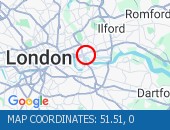
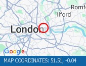
M23 Southbound - Broken down vehicle×
 Broken down vehicle
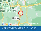
 Location : The M23 southbound between junctions J8 (Reigate) and J9 (Gatwick Airport) .
Lane Closures : Lane one is closed.
Reason : Broken down vehicle.
Status : Currently Active.
Time To Clear : The event is expected to clear between 10:00 and 10:15 on 28/04/2024.
Return To Normal : Normal traffic conditions are expected between 10:00 and 10:15 on 28/04/2024.
Lanes Closed : There is one of four lanes closed.
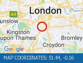
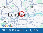
CLEARED @ 09:26Location:
M23, 4m of
Caterham,
Surrey
Street View M23 camera (Streetview):
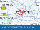
A2 Eastbound - Accident×
 Accident
 Location : The A2 eastbound entry slip from the A2018 .
Reason : Accident involving a vehicle that has left the carriageway.
Status : Currently Active.
Time To Clear : The event is expected to clear between 11:00 and 11:15 on 28/04/2024.
Return To Normal : Normal traffic conditions are expected between 11:00 and 11:15 on 28/04/2024.
Lanes Closed : There are lane closures.
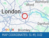
CLEARED @ 09:44Location:
A2, 1.65m of
Bexleyheath,
Kent
Street View A2 camera (Streetview):
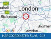
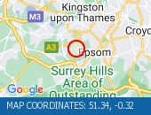
M25 Southbound - Broken down vehicle×
 Broken down vehicle
 Location : The M25 clockwise between junctions J5 (Sevenoaks) and J6 (East Grinstead) .
Lane Closures : Lane one is closed.
Reason : Broken down vehicle.
Status : Currently Active.
Time To Clear : The event is expected to clear between 11:15 and 11:30 on 28/04/2024.
Return To Normal : Normal traffic conditions are expected between 11:15 and 11:30 on 28/04/2024.
Lanes Closed : There is one of four lanes closed.
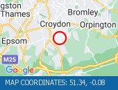
CLEARED @ 10:47Location:
M25, 1.94m of
Biggin Hill,
Surrey
Street View M25 camera (Streetview):
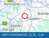
M20 Eastbound - Accident×
 Accident
 Location : The M20 eastbound between junctions J3 (Sevenoaks) and J4 (West Malling) .
Lane Closures : The hard shoulder and lane 1 are closed.
Reason : Road traffic collision.
Status : Currently Active.
Lanes Closed : There is one of four lanes closed.
CLEARED @ 10:47Location:
M20, 4m of
Aylesford,
Kent
Street View M20 camera (Streetview):
Factory Road All Directions - Albert Road junction with×
 Albert Road junction with Savi
 Albert Road junction with Saville Road (All Directions): There is a reported building fire at this location. All restrictions have now been lifted. There are no reports of congestion in the area.
Location: Factory Road, 2.15m of
Blackwall,
Greater London
Street View Factory Road camera (Streetview):
Blackwall Tunnel (Southbound Bore) South - Blackwall Tunnel (Southbo×
 Blackwall Tunnel (Southbound B
 Blackwall Tunnel (Southbound Bore) (Southbound): the broken down motorcycle in the tunnel has been removed. All congestion resulting from this broken down vehicle has cleared (although tailback remain at the present time - see separate entry).
Location: Blackwall Tunnel (Southbound Bore), 0.69m of
Blackwall,
Greater London
Street View Blackwall Tunnel (Southbound Bore) camera (Streetview):
Clapham Common All Directions - The Avenue (Southbound) a×
 The Avenue (Southbound) at the
 The Avenue (Southbound) at the junction of Windmill Drive - Lane one restrictions with single alternate lane traffic controlled by STOP / GO boards for BT works. Traffic is flowing well in the area.
Location: Clapham Common, 0.86m of
Balham,
Greater London
Street View Clapham Common camera (Streetview):
Ambrosden Avenue All Directions - Victoria Street (Westbou×
 Victoria Street (Westbound) b
 Victoria Street (Westbound) between Artillery Row and Bressenden Place. There will be a westbound closure to facilitate drainage works.
Location: Ambrosden Avenue, 0.34m of
Covent Garden,
Greater London
Street View Ambrosden Avenue camera (Streetview):
Limehouse Link All Directions - Limehouse Link Tunnel (We×
 Limehouse Link Tunnel (Westbou
 Limehouse Link Tunnel (Westbound) Lane one is blocked by a broken down vehicle. The vehicle has now been removed - all lanes are open.
Location: Limehouse Link, 0.56m of
Limehouse,
Greater London
Street View Limehouse Link camera (Streetview):
Limehouse Link Tunnel Both Directions - Limehouse Link Tunnel (Bo×
 Limehouse Link Tunnel (Both Di
 Limehouse Link Tunnel (Both Directions) - Closure overnight to facilitate works
Location: Limehouse Link Tunnel, 0.47m of
Limehouse,
Greater London
Street View Limehouse Link Tunnel camera (Streetview):
Fairoak Lane All Directions - Leatherhead Road (Northbo×
 Leatherhead Road (Northbound).
 Leatherhead Road (Northbound). Traffic is moving well. Traffic is moving well.
Location: Fairoak Lane, 1.06m of
Chessington,
Greater London
Street View Fairoak Lane camera (Streetview):
Bishopsford Road All Directions - Middleton Road (Both Dire×
 Middleton Road (Both Direction
 Middleton Road (Both Directions) between Bishopsford Road and St Helier Avenue - road closure to facilitate carriageway resurfacing. Local diversion in place.
Location: Bishopsford Road, 1.47m of
Camberwell,
Greater London
Street View Bishopsford Road camera (Streetview):
West Hill All Directions - West Hill (westbound) bet×
 West Hill (westbound) between
 West Hill (westbound) between Keswick Road and Portinscale Road. Partial lane one restriction. All lanes have reopened on West Hill -Works are complete - Traffic flows have returned to normal
Location: West Hill, 0.52m of
Wandsworth,
Greater London
Street View West Hill camera (Streetview):
Eatonville Road All Directions - Trinity Road (Both Direct×
 Trinity Road (Both Directions)
 Trinity Road (Both Directions) at the junction of Eatonville Road - Temporary traffic signals will be in place to facilitate water works.
Location: Eatonville Road, 1.51m of
Balham,
Greater London
Street View Eatonville Road camera (Streetview):
Trojan Way All Directions - Purley Way (Northbound) b×
 Purley Way (Northbound) betwee
 Purley Way (Northbound) between Whitestone Way and Commerce Way - Lane restrictions to facilitate carriageway chamber access works for new connections. (Night works only)
Location: Trojan Way, 1.11m of
Croydon,
Greater London
Street View Trojan Way camera (Streetview):
Larkbere Road All Directions - Sydenham Road (Both Direc×
 Sydenham Road (Both Directions
 Sydenham Road (Both Directions) at the junction of Larkbere Road - Reports of an accident at this location. Traffic is flowing well.
Location: Larkbere Road, 1.87m of
Lewisham,
Greater London
Street View Larkbere Road camera (Streetview):
Crittalls Corner All Directions - Sidcup By-pass Road (East×
 Sidcup By-pass Road (Eastbound
 Sidcup By-pass Road (Eastbound) at the junction of Crittlls Corner - The A20 will be closed between Crittalls Corner and the M25 J3 for overnight works.
Location: Crittalls Corner, 0.31m of
Sidcup,
Greater London
Street View Crittalls Corner camera (Streetview):
Longlands Road All Directions - Station Road (All Directi×
 Station Road (All Directions)a
 Station Road (All Directions)at the junction of Longlands Road will have various road closures in place for the duration of the works.
Location: Longlands Road, 1.32m of
Sidcup,
Greater London
Street View Longlands Road camera (Streetview):
Long Road All Directions - Clapham Common North Side×
 Clapham Common North Side (Eas
 Clapham Common North Side (Eastbound) at the junction of Long Road . Road reopened and traffic is moving well.
Location: Long Road, 0.88m of
Balham,
Greater London
Street View Long Road camera (Streetview):
Lingham Street All Directions - Clapham Road (Both Direct×
 Clapham Road (Both Directions)
 Clapham Road (Both Directions) at the junction of Lingham Street- there is a collision at this location. Road reopened - accident cleared
Location: Lingham Street, 1.48m of
Balham,
Greater London
Street View Lingham Street camera (Streetview):
Ryecotes Mead All Directions - Dulwich Common (Both Dire×
 Dulwich Common (Both Direction
 Dulwich Common (Both Directions) at the junction of Ryecotes Mead - All lanes are now open. All lanes are now open. Traffic is flowing well in the area.
Location: Ryecotes Mead, 0.49m of
East Dulwich,
Greater London
Street View Ryecotes Mead camera (Streetview):
Stainer Street All Directions - Tooley Street (Both Direc×
 Tooley Street (Both Directions
 Tooley Street (Both Directions) at the junction of Stainer Street - Temporary signals in operation to facilitate works by Colt.
Location: Stainer Street, 0.29m of
Finsbury,
Greater London
Street View Stainer Street camera (Streetview):
Old Bond Street All Directions - A4 Piccadilly (Eastbound)×
 A4 Piccadilly (Eastbound) at t
 A4 Piccadilly (Eastbound) at the junction of Old Bond Street - lane restriction due in to facilitate crane operation. Currently no visible restrictions. Traffic flow is light with no delays.
Location: Old Bond Street, 0.69m of
Covent Garden,
Greater London
Street View Old Bond Street camera (Streetview):
Blackfriars Underpass West Bound - Blackfriars Underpass (We×
 Blackfriars Underpass (Westbou
 Blackfriars Underpass (Westbound) - broken down vehicle removed. Vehicle removed. Traffic is moving well.
Location: Blackfriars Underpass, 0.8m of
Bloomsbury,
Greater London
Street View Blackfriars Underpass camera (Streetview):
Leonard Street All Directions - City Road (All Directions×
 City Road (All Directions) at
 City Road (All Directions) at the junction of Leonard Street - Temporary traffic signals in operation to facilitate road works. No restrictions in place - Traffic light and flowing well
Location: Leonard Street, 0.64m of
Shoreditch,
Greater London
Street View Leonard Street camera (Streetview):
Alie Street All Directions - Leman Street (Southbound)×
 Leman Street (Southbound) at t
 Leman Street (Southbound) at the junction of Alie Street - lane closure to facilitate new water connection to property by Thames Water. No visible restrictions in place.
Location: Alie Street, 0.91m of
Whitechapel,
Greater London
Street View Alie Street camera (Streetview):
Limehouse Link Tunnel East Bound - Limehouse Link Tunnel (Ea×
Limehouse Link Tunnel (Eastbou Limehouse Link Tunnel (Eastbound) - lane one blocked due to broken down car. Vehicle has now been recovered. All lanes now reopen. Traffic flowing well.
Location: Limehouse Link Tunnel, 0.56m of
Limehouse,
Greater London
Street View Limehouse Link Tunnel camera (Streetview):
Dupree Road All Directions - Hardman Road (All Directi×
 Hardman Road (All Directions)
 Hardman Road (All Directions) at the junction of Dupree Road - Lane restrictions to facilitate roadworks All restrictions have been removed - Traffic flows have returned to normal
Location: Dupree Road, 1.03m of
Cubitt Town,
Greater London
Street View Dupree Road camera (Streetview):
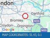
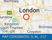
Purley Downs Road All Directions - Sanderstead Hill (Both Di×
 Sanderstead Hill (Both Directi
 Sanderstead Hill (Both Directions) at the junction of Sundown Avenue - Possible lane closures because of a collision. The road has reopened.
Location: Purley Downs Road, 3.04m of
Carshalton,
Greater London
Street View Purley Downs Road camera (Streetview):
Bolingbroke Grove All Directions - Nightingale Lane (Both Di×
 Nightingale Lane (Both Directi
 Nightingale Lane (Both Directions) between Bolingbroke Grove and Balham Hill - road closed to facilitate carriageway resurfacing. Expect delays on approach.
Location: Bolingbroke Grove, 1.3m of
Balham,
Greater London
Street View Bolingbroke Grove camera (Streetview):
St John's Road All Directions - Battersea Rise (Eastbound×
 Battersea Rise (Eastbound) at
 Battersea Rise (Eastbound) at the junction of St John's Road - Lane one closure in place to remove and build a bus shelter.
Location: St John's Road, 1.44m of
Camden Town,
Greater London
Street View St John's Road camera (Streetview):
Gliddon Road All Directions - Talgarth Road (Westbound)×
 Talgarth Road (Westbound) betw
 Talgarth Road (Westbound) between Gliddon Road North End Road - Lane one is blocked following a collision. Traffic is slow moving on approach, expect delays.
Location: Gliddon Road, 0.71m of
Shepherds Bush,
Greater London
Street View Gliddon Road camera (Streetview):
Marble Arch All Directions - Oxford Street (Eastbound)×
 Oxford Street (Eastbound) at t
 Oxford Street (Eastbound) at the junction of Marble Arch - lane closure to facilitate bus shelter maintenance.
Location: Marble Arch, 1m of
Marylebone,
Greater London
Street View Marble Arch camera (Streetview):
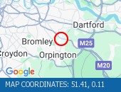
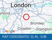
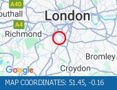
Crown Lane All Directions - Bromley Common (Southboun×
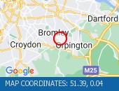 Bromley Common (Southbound) at
 Bromley Common (Southbound) at the junction of Crown Lane - There is a collision at this location. The southbound carriageway is blocked due a collision. Police are directing traffic. Expect delays
Location: Crown Lane, 0.91m of
Bromley,
Greater London
Street View Crown Lane camera (Streetview):
 Highways Agency
 The AA
 Traffic Cymru
 Traffic Scotland
 YOUR AD HERE