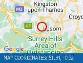
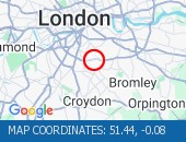
M4 Westbound - Broken down vehicle×
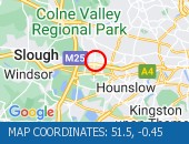 Broken down vehicle
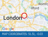
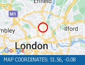
 Location : The M4 westbound exit slip at junction J4 .
Lane Closures : Lane one is closed.
Reason : Broken down vehicle.
Status : Currently Active.
Time To Clear : The event is expected to clear between 00:30 and 00:45 on 27/04/2024.
Return To Normal : Normal traffic conditions are expected between 00:30 and 00:45 on 27/04/2024.
Lanes Closed : There is one of two lanes closed.
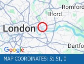
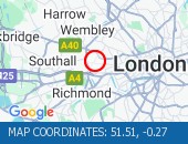
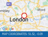
CLEARED @ 23:59Location:
M4, 1.96m of
Heathrow,
Greater London Authority
Street View M4 camera (Streetview):
Don't get stuck in traffic when you're out and about. Use our SMS service to get the latest traffic conditions instantly to your mobile phone.
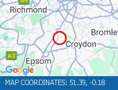
Western Avenue All Directions - Western Avenue (Eastbound×
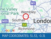 Western Avenue (Eastbound) nea
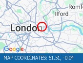
 Western Avenue (Eastbound) near the junction with Alperton Lane - Collision - Lane one reopened. Traffic is flowing well for the time of day.
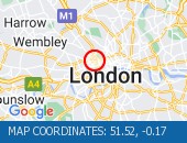
Location: Western Avenue, 1.68m of
Wembley,
Greater London
Street View Western Avenue camera (Streetview):
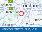
Factory Road All Directions - Albert Road junction with×
 Albert Road junction with Savi
 Albert Road junction with Saville Road (All Directions): There is a reported building fire at this location. All restrictions have now been lifted. There are no reports of congestion in the area.
Location: Factory Road, 2.15m of
Blackwall,
Greater London
Street View Factory Road camera (Streetview):
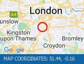
Western Avenue All Directions - Swakeleys Roundabout - Th×
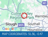 Swakeleys Roundabout - There i
 Swakeleys Roundabout - There is a broken down car on the eastbound on slip road to the A40. All lanes are open.
Location: Western Avenue, 0.87m of
Uxbridge,
Greater London
Street View Western Avenue camera (Streetview):
Blackwall Tunnel (Southbound Bore) South - Blackwall Tunnel (Southbo×
 Blackwall Tunnel (Southbound B
 Blackwall Tunnel (Southbound Bore) (Southbound): the broken down motorcycle in the tunnel has been removed. All congestion resulting from this broken down vehicle has cleared (although tailback remain at the present time - see separate entry).
Location: Blackwall Tunnel (Southbound Bore), 0.69m of
Blackwall,
Greater London
Street View Blackwall Tunnel (Southbound Bore) camera (Streetview):
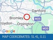
Ripple Road East Bound - Ripple Road (Eastbound) -×
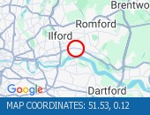 Ripple Road (Eastbound) - Lane
 Ripple Road (Eastbound) - Lane three (of three) blocked due to a broken down vehicle. The accident has been cleared and lane three has been reopened to traffic. Traffic flows are returning to normal for the time of day.
Location: Ripple Road, 1.69m of
Barking,
Greater London
Street View Ripple Road camera (Streetview):
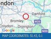
Grotto Road All Directions - Cross Deep (All Direction×
 Cross Deep (All Directions) ju
 Cross Deep (All Directions) junction with Grotto Road. All closures have been removed - Traffic flows have returned to normal in the area
Location: Grotto Road, 1.03m of
Twickenham,
Greater London
Street View Grotto Road camera (Streetview):
Clapham Common All Directions - The Avenue (Southbound) a×
 The Avenue (Southbound) at the
 The Avenue (Southbound) at the junction of Windmill Drive - Lane one restrictions with single alternate lane traffic controlled by STOP / GO boards for BT works. Traffic is flowing well in the area.
Location: Clapham Common, 0.86m of
Balham,
Greater London
Street View Clapham Common camera (Streetview):
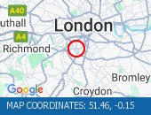
Ambrosden Avenue All Directions - Victoria Street (Westbou×
 Victoria Street (Westbound) b
 Victoria Street (Westbound) between Artillery Row and Bressenden Place. There will be a westbound closure to facilitate drainage works.
Location: Ambrosden Avenue, 0.34m of
Covent Garden,
Greater London
Street View Ambrosden Avenue camera (Streetview):
Limehouse Link All Directions - Limehouse Link Tunnel (We×
 Limehouse Link Tunnel (Westbou
 Limehouse Link Tunnel (Westbound) Lane one is blocked by a broken down vehicle. The vehicle has now been removed - all lanes are open.
Location: Limehouse Link, 0.56m of
Limehouse,
Greater London
Street View Limehouse Link camera (Streetview):
Limehouse Link Tunnel Both Directions - Limehouse Link Tunnel (Bo×
 Limehouse Link Tunnel (Both Di
 Limehouse Link Tunnel (Both Directions) - Closure overnight to facilitate works
Location: Limehouse Link Tunnel, 0.47m of
Limehouse,
Greater London
Street View Limehouse Link Tunnel camera (Streetview):
North Circular Road All Directions - Bowes Road (North Circula×
 Bowes Road (North Circular Roa
 Bowes Road (North Circular Road) (All Directions) - The traffic signals are not operating under central computer control at this junction. Traffic signals at this location are now on and working.
Location: North Circular Road, 0.51m of
Palmers Green,
Greater London
Street View North Circular Road camera (Streetview):
Walthamstow Avenue (North Circular Road) - Walthamstow Avenue (North×
 Walthamstow Avenue (North Circ
 Walthamstow Avenue (North Circular Road) (Eastbound) On approach to the Crooked Billet Roundabout. Partial restriction of the off slip towards the roundabout due to an accident. The collision has been cleared. All lanes are open.
Location: Walthamstow Avenue (North Circular Road), 0.52m of
Walthamstow,
Greater London
Street View Walthamstow Avenue (North Circular Road) camera (Streetview):
Fairoak Lane All Directions - Leatherhead Road (Northbo×
 Leatherhead Road (Northbound).
 Leatherhead Road (Northbound). Traffic is moving well. Traffic is moving well.
Location: Fairoak Lane, 1.06m of
Chessington,
Greater London
Street View Fairoak Lane camera (Streetview):
Bishopsford Road All Directions - Middleton Road (Both Dire×
 Middleton Road (Both Direction
 Middleton Road (Both Directions) between Bishopsford Road and St Helier Avenue - road closure to facilitate carriageway resurfacing. Local diversion in place.
Location: Bishopsford Road, 1.47m of
Camberwell,
Greater London
Street View Bishopsford Road camera (Streetview):
West Hill All Directions - West Hill (westbound) bet×
 West Hill (westbound) between
 West Hill (westbound) between Keswick Road and Portinscale Road. Partial lane one restriction. All lanes have reopened on West Hill -Works are complete - Traffic flows have returned to normal
Location: West Hill, 0.52m of
Wandsworth,
Greater London
Street View West Hill camera (Streetview):
Eatonville Road All Directions - Trinity Road (Both Direct×
 Trinity Road (Both Directions)
 Trinity Road (Both Directions) at the junction of Eatonville Road - Temporary traffic signals will be in place to facilitate water works.
Location: Eatonville Road, 1.51m of
Balham,
Greater London
Street View Eatonville Road camera (Streetview):
Rectory Road All Directions - Horn Lane (All Directions×
 Horn Lane (All Directions) at
 Horn Lane (All Directions) at the junction of Rectory Road - Three-way temporary signals in operation to facilitate works by BT. Traffic is flowing well in the area.
Location: Rectory Road, 1.16m of
Acton,
Greater London
Street View Rectory Road camera (Streetview):
Marylebone Flyover All Directions - Marylebone Road (Eastbou×
 Marylebone Road (Eastbound) l
 Marylebone Road (Eastbound) lane one closed due to a broken down van. Vehicle has been recovered.
Location: Marylebone Flyover, 1.08m of
Saint Johns Wood,
Greater London
Street View Marylebone Flyover camera (Streetview):
Trojan Way All Directions - Purley Way (Northbound) b×
 Purley Way (Northbound) betwee
 Purley Way (Northbound) between Whitestone Way and Commerce Way - Lane restrictions to facilitate carriageway chamber access works for new connections. (Night works only)
Location: Trojan Way, 1.11m of
Croydon,
Greater London
Street View Trojan Way camera (Streetview):
Larkbere Road All Directions - Sydenham Road (Both Direc×
 Sydenham Road (Both Directions
 Sydenham Road (Both Directions) at the junction of Larkbere Road - Reports of an accident at this location. Traffic is flowing well.
Location: Larkbere Road, 1.87m of
Lewisham,
Greater London
Street View Larkbere Road camera (Streetview):
Crittalls Corner All Directions - Sidcup By-pass Road (East×
 Sidcup By-pass Road (Eastbound
 Sidcup By-pass Road (Eastbound) at the junction of Crittlls Corner - The A20 will be closed between Crittalls Corner and the M25 J3 for overnight works.
Location: Crittalls Corner, 0.31m of
Sidcup,
Greater London
Street View Crittalls Corner camera (Streetview):
Longlands Road All Directions - Station Road (All Directi×
 Station Road (All Directions)a
 Station Road (All Directions)at the junction of Longlands Road will have various road closures in place for the duration of the works.
Location: Longlands Road, 1.32m of
Sidcup,
Greater London
Street View Longlands Road camera (Streetview):
Long Road All Directions - Clapham Common North Side×
 Clapham Common North Side (Eas
 Clapham Common North Side (Eastbound) at the junction of Long Road . Road reopened and traffic is moving well.
Location: Long Road, 0.88m of
Balham,
Greater London
Street View Long Road camera (Streetview):
Lingham Street All Directions - Clapham Road (Both Direct×
 Clapham Road (Both Directions)
 Clapham Road (Both Directions) at the junction of Lingham Street- there is a collision at this location. Road reopened - accident cleared
Location: Lingham Street, 1.48m of
Balham,
Greater London
Street View Lingham Street camera (Streetview):
Ryecotes Mead All Directions - Dulwich Common (Both Dire×
 Dulwich Common (Both Direction
 Dulwich Common (Both Directions) at the junction of Ryecotes Mead - All lanes are now open. All lanes are now open. Traffic is flowing well in the area.
Location: Ryecotes Mead, 0.49m of
East Dulwich,
Greater London
Street View Ryecotes Mead camera (Streetview):
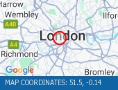
Stainer Street All Directions - Road closed for telecoms ×
 Road closed for telecoms work.
 Road closed for telecoms work. Diversions in operation. The tunnel remains closed. Use an alternative route.
Location: Stainer Street, 0.29m of
Finsbury,
Greater London
Street View Stainer Street camera (Streetview):
Old Bond Street All Directions - A4 Piccadilly (Both Direc×
 A4 Piccadilly (Both Directions
 A4 Piccadilly (Both Directions) at the junction of Old Bond Street - Lane restrictions in both directions to facilitate building maintenance works. Lane restrictions have been cleared.
Location: Old Bond Street, 0.69m of
Covent Garden,
Greater London
Street View Old Bond Street camera (Streetview):
Blackfriars Underpass West Bound - Blackfriars Underpass (We×
 Blackfriars Underpass (Westbou
 Blackfriars Underpass (Westbound) - broken down vehicle removed. Vehicle removed. Traffic is moving well.
Location: Blackfriars Underpass, 0.8m of
Bloomsbury,
Greater London
Street View Blackfriars Underpass camera (Streetview):
Leonard Street All Directions - City Road (All Directions×
 City Road (All Directions) at
 City Road (All Directions) at the junction of Leonard Street - Temporary traffic signals in operation to facilitate road works. No restrictions in place - Traffic light and flowing well
Location: Leonard Street, 0.64m of
Shoreditch,
Greater London
Street View Leonard Street camera (Streetview):
Alie Street All Directions - Leman Street (Southbound)×
 Leman Street (Southbound) at t
 Leman Street (Southbound) at the junction of Alie Street - lane closure to facilitate new water connection to property by Thames Water. No visible restrictions in place.
Location: Alie Street, 0.91m of
Whitechapel,
Greater London
Street View Alie Street camera (Streetview):
Limehouse Link Tunnel East Bound - Limehouse Link Tunnel (Ea×
Limehouse Link Tunnel (Eastbou Limehouse Link Tunnel (Eastbound) - lane one blocked due to broken down car. Vehicle has now been recovered. All lanes now reopen. Traffic flowing well.
Location: Limehouse Link Tunnel, 0.56m of
Limehouse,
Greater London
Street View Limehouse Link Tunnel camera (Streetview):
Dupree Road All Directions - Hardman Road (All Directi×
 Hardman Road (All Directions)
 Hardman Road (All Directions) at the junction of Dupree Road - Lane restrictions to facilitate roadworks All restrictions have been removed - Traffic flows have returned to normal
Location: Dupree Road, 1.03m of
Cubitt Town,
Greater London
Street View Dupree Road camera (Streetview):
Harrington Square All Directions - Hampstead Road junction w×
 Hampstead Road junction with H
 Hampstead Road junction with Harrington Square (Southbound): There is a low defective road sign at this location. The sign has now been made safe.
Location: Harrington Square, 1.55m of
Bloomsbury,
Greater London
Street View Harrington Square camera (Streetview):
Stoke Newington Church Street All Direct - Stoke Newington High Stre×
 Stoke Newington High Street (B
 Stoke Newington High Street (Both Directions) at the junction of Stoke Newington Church Street. Traffic lights are working. Traffic signals are on and working. Traffic is moving well.
Location: Stoke Newington Church Street, 0.48m of
Stoke Newington,
Greater London
Street View Stoke Newington Church Street camera (Streetview):
 Highways Agency
 The AA
 Traffic Cymru
 Traffic Scotland
 YOUR AD HERE