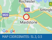
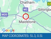
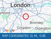
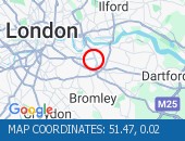
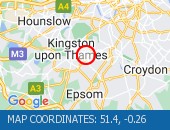
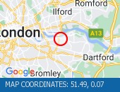
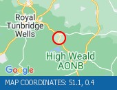
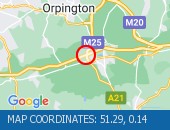
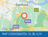
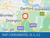
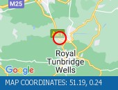
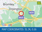
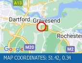
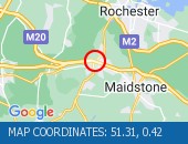
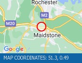
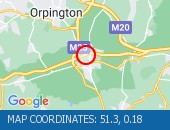
Location: westbound between junctions J6 (Maidstone) and J5 (Aylesford) .
Due to: Road traffic collision.
Time To Clear : The event is expected to clear between 14:45 and 15:00 on 27 April 2024.
Normal traffic conditions are expected between 15:30 and 15:45 on 27 April 2024.
Lanes Closed : All lanes are closed.
Nearest town: 18.22 miles from The Chart.
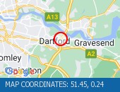
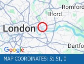
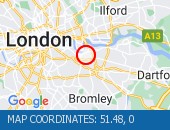
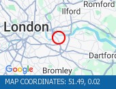
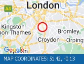
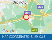
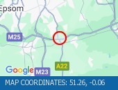
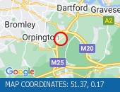
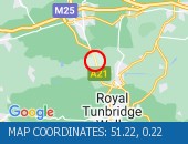
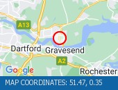
Location: anticlockwise between junctions J2 (London (SE)) and J1A (Erith) .
Lane Closures : Lanes 3 and 4 are closed.
Due to: Road traffic collision.
Time To Clear : The event is expected to clear between 16:15 and 16:30 on 27 April 2024.
Normal traffic conditions are expected between 16:45 and 17:00 on 27 April 2024.
Lanes Closed : There are two of four lanes closed.
Nearest town: 15.34 miles from The Chart.
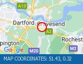
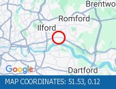
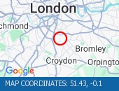
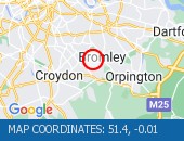
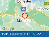
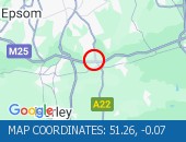
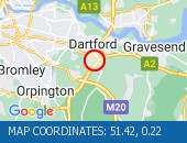
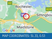
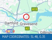
Location: eastbound at the junction with the A2260 .
Lane Closures : The hard shoulder and lane 1 are closed.
Due to: Road traffic collision.
Time To Clear : The event is expected to clear between 11:30 and 11:45 on 27 April 2024.
Normal traffic conditions are expected between 11:30 and 11:45 on 27 April 2024.
Lanes Closed : There is one of four lanes closed.
Nearest town: 15.93 miles from The Chart.
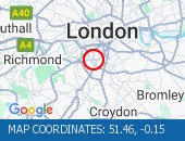
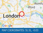
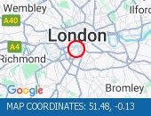
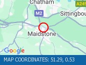
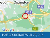
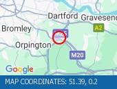
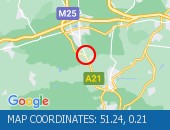
Location: westbound between junctions J6 (Maidstone) and J5 (Aylesford) .
Lane Closures : Lane two is closed.
Due to: Road Management.
Time To Clear : The event is expected to clear between 11:45 and 12:00 on 27 April 2024.
Normal traffic conditions are expected between 12:00 and 12:15 on 27 April 2024.
Lanes Closed : There is one of two lanes closed.
Nearest town: 18.39 miles from The Chart.
Rotherhithe Tunnel (All Directions) - Tunnel has fully re-opened.
Traffic flows are returning to normal for time of day.
Tunnel has fully re-opened.
Traffic flows are returning to normal for time of day.
Nearest town: 18.5 miles from The Chart.
St Paul's Way (Both Directions) between Burgess Street and Bow Common Lane - Road closure to facilitate roadworks No restrictions in place.
Nearest town: 19.31 miles from The Chart.
Tolworth Rise North (Northbound) - Lane restriction on on-slip to northbound A3 at the junction of Fairmead due to emergency gas works.
Restrictions have been removed.
All lanes open.
Nearest town: 18.39 miles from The Chart.
Albert Road junction with Saville Road (All Directions): There is a reported building fire at this location.
All restrictions have now been lifted.
There are no reports of congestion in the area.
Nearest town: 17.63 miles from The Chart.
Leatherhead Road (Northbound).
Traffic is moving well.
Traffic is moving well.
Nearest town: 18.9 miles from The Chart.
West Hill (westbound) between Keswick Road and Portinscale Road.
Partial lane one restriction.
All lanes have reopened on West Hill -Works are complete - Traffic flows have returned to normal
Nearest town: 19.24 miles from The Chart.
Sydenham Road (Both Directions) at the junction of Larkbere Road - Reports of an accident at this location.
Traffic is flowing well.
Nearest town: 13.58 miles from The Chart.
Clapham Common North Side (Eastbound) at the junction of Long Road .
Road reopened and traffic is moving well.
Nearest town: 17.83 miles from The Chart.
Dulwich Common (Both Directions) at the junction of Ryecotes Mead - All lanes are now open.
All lanes are now open.
Traffic is flowing well in the area.
Nearest town: 15.35 miles from The Chart.
Road closed for telecoms work.
Diversions in operation.
The tunnel remains closed.
Use an alternative route.
Nearest town: 19.21 miles from The Chart.
Harleyford Road junction with Kennington Oval (Northbound) There is a collision at this location.
Traffic is moving well.
Nearest town: 18.58 miles from The Chart.
Gracechurch Street (Both Directions) at the junction of Lombard Street.
Lane one closed to facilitate repairs to a blockage.
Traffic is flowing well in the area.
Nearest town: 19.67 miles from The Chart.
Blackwall Tunnel Northern Approach (Southbound) at the junction of East India Dock Road - Congestion due cleared.
A12 Southbound traffic flows have returned to normal for the time of day.
Nearest town: 18.72 miles from The Chart.
Threadneedle Street (Eastbound) at the junction of Bishopsgate - A parked lorry is causing an obstruction.
Broken down vehicle has been moved.
Traffic flowing well.
Nearest town: 19.85 miles from The Chart.
Rotherhithe Tunnel (Northbound) there is a broken down vehicle paritally blocking the road.
Approach with care.
The tunnel has been opened in both directions.
Traffic is light and flowing well in the area.
Nearest town: 18.97 miles from The Chart.
Burlington Road between High Street and Malden Way (Kingston By Pass) - road is closed due to a fire.
Traffic is flowing well.
Nearest town: 17.8 miles from The Chart.
Greenwich High Road (Westbound) at the junction of Greenwich South Street - now clear.
Traffic is moving well.
Nearest town: 16.46 miles from The Chart.
Marsham Street (All Directions) at the junction of Page Street - Lane restrictions controlled by three-way temporary traffic signals to facilitate telecomm ducting works.
Restrictions have been removed and all lanes are open.
Nearest town: 19.42 miles from The Chart.
Lane closure to facilitate water works There are no reports of congestion in the area.
Nearest town: 19.93 miles from The Chart.
Clapham Road (Both Directions) at the junction of Lingham Street- there is a collision at this location.
Road reopened - accident cleared
Nearest town: 17.93 miles from The Chart.
West Hill (Westbound) at the junction of Upper Richmond Road - Lane two blocked due to broken down van.
The broken down van has been recovered and traffic flows ahve returned to normal.
Nearest town: 19.18 miles from The Chart.
SFM Asset: 06/000001Shooters Hill Road (All Directions) at the junction of Prince Of Wales Road - The traffic lights are not working The traffic lights are not working at this junction, approach with care
Nearest town: 15.88 miles from The Chart.
Shooters Hill Road (All Directions) The traffic lights at the junction are now working.
Traffic is moving well.
Nearest town: 15.85 miles from The Chart.
Blackwall Tunnel (Southbound Bore) (Southbound): the broken down motorcycle in the tunnel has been removed.
All congestion resulting from this broken down vehicle has cleared (although tailback remain at the present time - see separate entry).
Nearest town: 18.33 miles from The Chart.
Ripple Road (Eastbound) - Lane three (of three) blocked due to a broken down vehicle.
The accident has been cleared and lane three has been reopened to traffic.
Traffic flows are returning to normal for the time of day.
Nearest town: 19.61 miles from The Chart.
The Avenue (Southbound) at the junction of Windmill Drive - Lane one restrictions with single alternate lane traffic controlled by STOP / GO boards for BT works.
Traffic is flowing well in the area.
Nearest town: 17.71 miles from The Chart.
Blackfriars Underpass (Westbound) - broken down vehicle removed.
Vehicle removed.
Traffic is moving well.
Nearest town: 19.91 miles from The Chart.
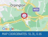
High Street (All Directions) at the junction of Homefield Rise - Temporary Traffic Signals to facilitate works Traffic is moving well.
Nearest town: 8.77 miles from The Chart.
Bromley Common (Southbound) at the junction of Johnson Road - Road now reopened.
Traffic is moving well.
Nearest town: 10.06 miles from The Chart.
Ludgate Circus (All Directions) - there is a early morning ceremonial rehearsal taking place involving full road closures from The Aldwych to Mansion House.
All closures have now been lifted, residual delays are clearing from High Holborn area.
Nearest town: 19.96 miles from The Chart.
Battersea Park Road (Eastbound) at the junction of Battersea Bridge Road - Lane one is closed due to an emergency gas leak Traffic flows are normal for the time of day.
Nearest town: 19.03 miles from The Chart.
A13 Ripple Road (Eastbound) just after the entry slip from Lodge Avenue - All lanes reopened following a collision.
Traffic flows are normal for the time of day.
Nearest town: 19.68 miles from The Chart.
Leman Street (Southbound) at the junction of Alie Street - lane closure to facilitate new water connection to property by Thames Water.
No visible restrictions in place.
Nearest town: 19.61 miles from The Chart.
Newham Way (Eastbound) at the junction of Noel Road - All lanes now open.
All lanes now open.
Nearest town: 18.83 miles from The Chart.
High Street (Both Directions) at the junction of Cambridge Road - 2-way temporary traffic signals in operation to facilitate new gas connection now removed.
Traffic is moving well.
Nearest town: 18.35 miles from The Chart.
Trafalgar Road (Eastbound) at the junction of Park Row - Lane blocked due to a broken down tanker The broken down has now been removed and all lanes are open.
Traffic is flowing well
Nearest town: 16.68 miles from The Chart.
Norwood Road (Southbound) at the junction of Robson Road - Waterworks completed.
Traffic is moving well.
Nearest town: 15.28 miles from The Chart.
Limehouse Link Tunnel (Westbound) Lane one is blocked by a broken down vehicle.
The vehicle has now been removed - all lanes are open.
Nearest town: 18.73 miles from The Chart.
Limehouse Link Tunnel (Eastbound) - lane one blocked due to broken down car.
Vehicle has now been recovered.
All lanes now reopen.
Traffic flowing well.
Nearest town: 18.73 miles from The Chart.
Hardman Road (All Directions) at the junction of Dupree Road - Lane restrictions to facilitate roadworks All restrictions have been removed - Traffic flows have returned to normal
Nearest town: 16.72 miles from The Chart.
Sanderstead Hill (Both Directions) at the junction of Sundown Avenue - Possible lane closures because of a collision.
The road has reopened.
Nearest town: 9.68 miles from The Chart.
Battersea Rise (Eastbound) at the junction of St John's Road - Lane one closure in place to remove and build a bus shelter.
Nearest town: 18.46 miles from The Chart.
Bromley Common (Southbound) at the junction of Crown Lane - There is a collision at this location.
The southbound carriageway is blocked due a collision.
Police are directing traffic.
Expect delays
Nearest town: 10.01 miles from The Chart.
Thurston Road (Both Directions) at the junction of Leathwell Road - The road will be closed overnight to facilitate bridge maintenance works.
Nearest town: 15.86 miles from The Chart.
Purley Way (Northbound) between Whitestone Way and Commerce Way - Lane closure for BT works.
Nearest town: 12.54 miles from The Chart.
Great Dover Street (Southbound) at the junction of Silvester Street - Lane one width restriction to facilitate a new supply scheme by UK Power Networks.
Times: Monday to Friday 08:00 - 17:00, Saturday 09:00 - 13:00, Sunday 10:00 - 13:00 Bus lane restriction in place.
Traffic is moving well on approach.
Nearest town: 19.11 miles from The Chart.
On Tolworth Broadway (Southbound) at the junction with A3 Tolworth Roundabout, there is a broken down vehicle blocking lane two of three).
Approach with caution.
All lanes have reopened.
Traffic is flowing well.
Nearest town: 18.42 miles from The Chart.
Victoria Street (Westbound) between Artillery Row and Bressenden Place.
There will be a westbound closure to facilitate drainage works.
Nearest town: 19.8 miles from The Chart.
Limehouse Link Tunnel (Both Directions) - Closure overnight to facilitate works
Nearest town: 18.98 miles from The Chart.
Trinity Road (Both Directions) at the junction of Eatonville Road - Temporary traffic signals will be in place to facilitate water works.
Nearest town: 17.1 miles from The Chart.
Purley Way (Northbound) between Whitestone Way and Commerce Way - Lane restrictions to facilitate carriageway chamber access works for new connections.
(Night works only)
Nearest town: 12.52 miles from The Chart.
Sidcup By-pass Road (Eastbound) at the junction of Crittlls Corner - The A20 will be closed between Crittalls Corner and the M25 J3 for overnight works.
Nearest town: 11.41 miles from The Chart.
Station Road (All Directions)at the junction of Longlands Road will have various road closures in place for the duration of the works.
Nearest town: 12.74 miles from The Chart.
Nightingale Lane (Both Directions) between Bolingbroke Grove and Balham Hill - road closed to facilitate carriageway resurfacing.
Expect delays on approach.
Nearest town: 17.62 miles from The Chart.
Balham Station Road (Both Directions) between Bedford Hill and Balham High Road - Road closed to facilitate carriageway resurfacing.
Use other routes.
Nearest town: 16.9 miles from The Chart.
Beresford Street (Both Directions) at the junction of Macbean Street - One lane closed to facilitate the creation of a new road junction for a hotel complex.
Lane one (of two) closure in place.
Traffic is moving well on approach.
Nearest town: 16.87 miles from The Chart.
Greyhound Lane (Both Directions) at the junction of Streatham High Road - 2 way temporary traffic signals in operation to facilitate carriageway resurfacing.
Nearest town: 15.28 miles from The Chart.
Beckenham Grove (Both Directions) between Scott's Lane and Shortlands Road - road closure to facilitate carriageway resurfacing.
Use other route.
Nearest town: 11.58 miles from The Chart.
Nine Elms Lane (Eastbound) at the junction of St George's Wharf - Lane one closed to facilitate the removal of hoarding.
Nearest town: 18.81 miles from The Chart.
High Street (All Directions) at the junction of Grosvenor Road - two way temporary traffic signals will be in operation to facilitate gas works.
There are no restrictions in place at the present time.
Traffic is flowing normally.
Nearest town: 10.06 miles from The Chart.
Gracechurch Street (Southbound) at the junction of Bell Inn Yard - lane restrictions due to water works
Nearest town: 19.76 miles from The Chart.
Lavender Hill (All Directions) at the junction of Falcon Road - Four-way temporary signals in operation to facilitate gully repairs.
Nearest town: 18.5 miles from The Chart.
Middleton Road (Both Directions) between Bishopsford Road and St Helier Avenue - road closure to facilitate carriageway resurfacing.
Local diversion in place.
Nearest town: 15.21 miles from The Chart.
Bromley Road (All Directions) at the junction of Beckenham Hill Road - Temporary Traffic Signals in operation to facilitate works
Nearest town: 13.09 miles from The Chart.
Victoria Street (Westbound) between Bressenden Place and Artillery Row - closed to facilitate drainage works.
Nearest town: 19.86 miles from The Chart.
Farnborough Common (Both Directions) at the junction of Hilda Vale Road - Temporary signals in operation to facilitate resurfacing works.
Nearest town: 8 miles from The Chart.
Bugsby's Way (Both Directions) at the junction of Peninsular Park Road - lane closure to enable Network Rail to carry out bridge repainting programme.
Nearest town: 16.94 miles from The Chart.
King William Street (All Directions) at the junction of Clements Lane - Stop/Go board in operation to facilitate a crane operation.
Nearest town: 19.7 miles from The Chart.
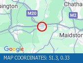
Location: anticlockwise at junction J1A (Erith) .
Due to: Congestion.
Normal traffic conditions are expected between 15:45 and 16:00 on 27 April 2024.
Delay : There are currently delays of 10 minutes against expected traffic.
Nearest town: 15.35 miles from The Chart.
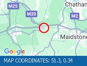
Location: anticlockwise entry slip at junction J1A (Erith) .
Due to: Congestion.
Normal traffic conditions are expected between 16:00 and 16:15 on 27 April 2024.
Delay : There are currently delays of 10 minutes against expected traffic.
Nearest town: 15.55 miles from The Chart.
Location: eastbound exit slip to the M25 .
Due to: Congestion.
Normal traffic conditions are expected between 15:00 and 15:15 on 27 April 2024.
Delay : There are currently delays of 10 minutes against expected traffic.
Nearest town: 13.76 miles from The Chart.
Location: eastbound entry slip from the M25 .
Due to: Congestion.
Normal traffic conditions are expected between 14:30 and 14:45 on 27 April 2024.
Delay : There are currently delays of 10 minutes against expected traffic.
Nearest town: 13.95 miles from The Chart.
Location: anticlockwise at junction J1A (Erith) .
Due to: Congestion.
Normal traffic conditions are expected between 14:15 and 14:30 on 27 April 2024.
Nearest town: 15.64 miles from The Chart.
Location: anticlockwise entry slip at junction J1A (Erith) .
Due to: Congestion.
Normal traffic conditions are expected between 14:15 and 14:30 on 27 April 2024.
Delay : There are currently delays of 10 minutes against expected traffic.
Nearest town: 15.55 miles from The Chart.
Location: anticlockwise at junction J1A (Erith) .
Due to: Congestion.
Normal traffic conditions are expected between 14:00 and 14:15 on 27 April 2024.
Nearest town: 15.64 miles from The Chart.
Location: westbound exit slip at junction J6 (Maidstone) .
Due to: Congestion.
Normal traffic conditions are expected between 13:30 and 13:45 on 27 April 2024.
Nearest town: 18.56 miles from The Chart.
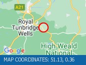
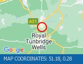
Location: anticlockwise between junctions J6 (East Grinstead) and J5 (Sevenoaks) .
Due to: Congestion.
Normal traffic conditions are expected between 12:45 and 13:00 on 27 April 2024.
Delay : There are currently delays of 10 minutes against expected traffic.
Nearest town: 2.05 miles from The Chart.
Location: northbound between the junctions with the A262 and the A228 .
Due to: Congestion.
Normal traffic conditions are expected between 12:30 and 12:45 on 27 April 2024.
Delay : There are currently delays of 10 minutes against expected traffic.
Nearest town: 15.09 miles from The Chart.
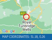
Location: southbound between the junctions with the A228 and the A262 .
Due to: Congestion.
Normal traffic conditions are expected between 12:00 and 12:15 on 27 April 2024.
Delay : There are currently delays of 10 minutes against expected traffic.
Nearest town: 15.09 miles from The Chart.
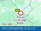
Location: northbound between the A268 and the junction with the A228 .
Due to: Congestion.
Normal traffic conditions are expected between 12:15 and 12:30 on 27 April 2024.
Delay : There are currently delays of 10 minutes against expected traffic.
Nearest town: 16.99 miles from The Chart.
Location: westbound exit slip at junction J6 (Maidstone) .
Due to: Congestion.
Normal traffic conditions are expected between 10:30 and 10:45 on 27 April 2024.
Delay : There are currently delays of 10 minutes against expected traffic.
Nearest town: 18.56 miles from The Chart.
Location: anticlockwise at junction J1A (Erith) .
Due to: Congestion.
Normal traffic conditions are expected between 10:30 and 10:45 on 27 April 2024.
Nearest town: 15.64 miles from The Chart.
Location: westbound entry slip at junction J6 (Maidstone) .
Due to: Congestion.
Normal traffic conditions are expected between 17:45 and 18:00 on 27 April 2024.
Earlier
Due to: Caused by the earlier emergency barrier repairs.
Nearest town: 18.06 miles from The Chart.
Location: westbound entry slip at junction J7 (Maidstone) .
Due to: Congestion.
Normal traffic conditions are expected between 16:15 and 16:30 on 27 April 2024.
Delay : There are currently delays of 10 minutes against expected traffic.
Nearest town: 19.36 miles from The Chart.
Location: westbound between junctions J6 (Maidstone) and J5 (Aylesford) .
Due to: Emergency barrier repairs.
Status : Cleared.
Nearest town: 18.35 miles from The Chart.
Location: westbound between junctions J6 (Maidstone) and J5 (Aylesford) .
Due to: Emergency barrier repairs.
Period : from 10:10 on 27 April 2024 to 16:00 on 27 April 2024.
Lanes Closed : All lanes are closed.
Nearest town: 18.77 miles from The Chart.
Location: westbound between junction J2A and the M25 .
Lane Closures : The hard shoulder and lane 1 are closed.
Due to: Road repairs.
Period : expect disruption until 05:30 on 31 March 2025.
Lanes Closed : There is one of two lanes closed.
Nearest town: 4.19 miles from The Chart.
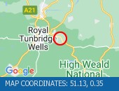
Location: clockwise between junctions J5 (Sevenoaks) and J6 (East Grinstead) .
Lane Closures : The hard shoulder and lane 1 are closed.
Due to: Road repairs.
Period : expect disruption until 05:30 on 31 March 2025.
Lanes Closed : There is one of four lanes closed.
Nearest town: 3.81 miles from The Chart.
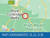
Location: anticlockwise between junctions J6 (East Grinstead) and J5 (Sevenoaks) .
Lane Closures : Lane one is closed.
Due to: Road repairs.
Period : expect disruption until 05:30 on 31 March 2025.
Lanes Closed : There is one of four lanes closed.
Nearest town: 6.34 miles from The Chart.
Location: anticlockwise at junction J1A (Erith) .
Lane Closures : Lanes 1 and 2 will be closed.
Due to: Roadworks are planned.
Status : Pending.
Schedule : From 22:00 on 27 April 2024 to 05:00 on 28 April 2024.
Lanes Closed : There will be two of four lanes closed.
Nearest town: 15.35 miles from The Chart.
Location: anticlockwise between junctions J6 (East Grinstead) and J5 (Sevenoaks) .
Lane Closures : Lanes 1, 2 and 3 will be closed.
Due to: Emergency roadworks are planned.
Status : Pending.
Schedule : From 23:00 on 26 April 2024 to 05:30 on 27 April 2024.
Schedule : From 22:00 on 27 April 2024 to 05:30 on 28 April 2024.
Lanes Closed : All lanes will be closed.
Nearest town: 7.07 miles from The Chart.
Location: anticlockwise entry slip at junction J6 (East Grinstead) .
Due to: Emergency roadworks are planned.
Status : Pending.
Schedule : From 22:00 on 27 April 2024 to 05:30 on 28 April 2024.
Lanes Closed : All lanes will be closed.
Nearest town: 6.69 miles from The Chart.
Location: clockwise between junctions J5 (Sevenoaks) and J6 (East Grinstead) .
Due to: Emergency roadworks are planned.
Status : Pending.
Schedule : From 22:30 on 28 April 2024 to 05:30 on 29 April 2024.
Lanes Closed : All lanes will be closed.
Nearest town: 3.24 miles from The Chart.
Location: northbound between the A262 and the junction with the M25 .
Due to: Roadworks scheme.
Period : from 20:13 on 10 April 2024 to 06:00 on 19 December 2024.
Nearest town: 13.4 miles from The Chart.
Location: southbound between the A25 and the junction with the A262 .
Due to: Roadworks scheme.
Period : from 20:12 on 12 April 2024 to 06:00 on 14 June 2024.
Nearest town: 4.92 miles from The Chart.
Location: clockwise between junctions J9 (Leatherhead) and J10 (Guildford) .
Lane Closures : Lanes 1, 2, 3 and 4 will be closed.
Due to: Roadworks are planned.
Status : Pending.
Schedule : From 21:00 on 10 May 2024 to 05:30 on 13 May 2024.
Lanes Closed : All lanes will be closed.
Nearest town: 18.32 miles from The Chart.
Location: westbound between the junctions with the M25 and the A223 .
Lane Closures : Lane one will be closed.
Due to: Roadworks are planned.
Status : Pending.
Schedule : From 23:00 on 3 May 2024 to 06:00 on 4 May 2024.
Schedule : Expect disruption everyday between 22:00 and 05:30 from 6 May 2024 to 8 May 2024.
Lanes Closed : There will be one of three lanes closed.
Nearest town: 10.77 miles from The Chart.
Location: clockwise exit slip at junction J4 (Bromley) .
Due to: Roadworks are planned.
Status : Pending.
Schedule : From 23:00 on 3 May 2024 to 05:30 on 4 May 2024.
Lanes Closed : All lanes will be closed.
Nearest town: 7.68 miles from The Chart.
Location: clockwise entry slip at junction J4 (Bromley) .
Due to: Roadworks are planned.
Status : Pending.
Schedule : From 23:00 on 3 May 2024 to 05:30 on 4 May 2024.
Lanes Closed : All lanes will be closed.
Nearest town: 7.34 miles from The Chart.
Location: westbound.
Due to: Roadworks scheme is planned.
Status : Pending.
Schedule : From 23:00 on 3 May 2024 to 05:30 on 8 May 2024.
Nearest town: 11.25 miles from The Chart.
Location: westbound.
Due to: Roadworks are planned.
Status : Pending.
Schedule : From 23:00 on 3 May 2024 to 06:00 on 4 May 2024.
Schedule : Expect disruption everyday between 22:00 and 05:30 from 6 May 2024 to 8 May 2024.
Lanes Closed : All lanes will be closed.
Nearest town: 11.25 miles from The Chart.
Location: westbound between the junctions with the M25 and the A223 .
Lane Closures : Lane one will be closed.
Due to: Roadworks are planned.
Status : Pending.
Schedule : From 23:00 on 3 May 2024 to 06:00 on 4 May 2024.
Schedule : Expect disruption everyday between 22:00 and 05:30 from 6 May 2024 to 8 May 2024.
Lanes Closed : There will be one of two lanes closed.
Nearest town: 11.19 miles from The Chart.
Location: clockwise between junctions J2 (London (SE)) and J3 (Maidstone) .
Lane Closures : Lanes 1, 2, 3 and 4 will be closed.
Due to: Litter clearance is planned.
Status : Pending.
Schedule : From 23:00 on 3 May 2024 to 05:00 on 4 May 2024.
Lanes Closed : All lanes will be closed.
Nearest town: 13.04 miles from The Chart.
Location: anticlockwise between junctions J3 (Maidstone) and J2 (London (SE)) .
Lane Closures : Lanes 1, 2 and 3 will be closed.
Due to: Litter clearance is planned.
Status : Pending.
Schedule : From 23:00 on 3 May 2024 to 05:00 on 4 May 2024.
Lanes Closed : All lanes will be closed.
Nearest town: 10.36 miles from The Chart.
Location: clockwise between junctions J8 (Reigate) and J9 (Leatherhead) .
Lane Closures : Lane four will be closed.
Due to: Roadworks are planned.
Status : Pending.
Schedule : From 23:00 on 3 May 2024 to 06:00 on 4 May 2024.
Lanes Closed : There will be one of four lanes closed.
Nearest town: 14.85 miles from The Chart.
Location: southbound between junctions J10A (Crawley) and J11 (Brighton) .
Lane Closures : Lane one will be closed.
Due to: Road marking works are planned.
Status : Pending.
Schedule : From 20:00 on 3 May 2024 to 05:00 on 4 May 2024.
Lanes Closed : There will be one of three lanes closed.
Nearest town: 16.21 miles from The Chart.
Location: southbound exit slip at junction J11 (Brighton) .
Due to: Road marking works are planned.
Status : Pending.
Schedule : From 20:00 on 3 May 2024 to 05:00 on 4 May 2024.
Lanes Closed : All lanes will be closed.
Nearest town: 16.42 miles from The Chart.
Location: anticlockwise between junctions J1A (Erith) and J31 (Thurrock) .
Lane Closures : Lane two will be closed.
Due to: Emergency barrier repairs are planned.
Status : Pending.
Schedule : From 22:30 on 28 April 2024 to 05:00 on 29 April 2024.
Lanes Closed : There will be one of two lanes closed.
Nearest town: 17 miles from The Chart.
Location: westbound between junctions J3 (Sevenoaks) and J1 .
Lane Closures : Lane one will be closed.
Due to: Roadworks are planned.
Status : Pending.
Schedule : From 22:00 on 2 May 2024 to 05:30 on 3 May 2024.
Lanes Closed : There will be one of three lanes closed.
Nearest town: 11.08 miles from The Chart.
Location: anticlockwise between junctions J4 (Bromley) and J3 (Maidstone) .
Lane Closures : Lanes 1 and 2 will be closed.
Due to: Litter clearance is planned.
Status : Pending.
Schedule : From 22:00 on 2 May 2024 to 05:00 on 3 May 2024.
Lanes Closed : There will be two of three lanes closed.
Nearest town: 8.86 miles from The Chart.
Location: anticlockwise entry slip at junction J3 (Maidstone) from A20.
Due to: Litter clearance is planned.
Status : Pending.
Schedule : From 22:00 on 2 May 2024 to 05:00 on 3 May 2024.
Lanes Closed : All lanes will be closed.
Nearest town: 10.71 miles from The Chart.
Location: anticlockwise exit slip at junction J3 (Maidstone) .
Due to: Litter clearance is planned.
Status : Pending.
Schedule : From 22:00 on 2 May 2024 to 05:00 on 3 May 2024.
Lanes Closed : All lanes will be closed.
Nearest town: 10.36 miles from The Chart.
Location: anticlockwise between junctions J3 (Maidstone) and J2 (London (SE)) .
Lane Closures : Lanes 1 and 2 will be closed.
Due to: Emergency barrier repairs are planned.
Status : Pending.
Schedule : From 22:00 on 29 April 2024 to 05:00 on 30 April 2024.
Lanes Closed : There will be two of four lanes closed.
Nearest town: 12.9 miles from The Chart.
Location: clockwise between junctions J3 (Maidstone) and J4 (Bromley) .
Lane Closures : Lanes 1 and 2 will be closed.
Due to: Litter clearance is planned.
Status : Pending.
Schedule : From 22:00 on 1 May 2024 to 05:00 on 2 May 2024.
Lanes Closed : There will be two of three lanes closed.
Nearest town: 11.29 miles from The Chart.
Location: westbound between junctions J3 (Sevenoaks) and J2 (Paddock Wood) .
Lane Closures : Lane one will be closed.
Due to: Emergency roadworks are planned.
Status : Pending.
Schedule : From 22:00 on 1 May 2024 to 05:00 on 2 May 2024.
Lanes Closed : There will be one of three lanes closed.
Nearest town: 12.32 miles from The Chart.
Location: clockwise entry slip at junction J3 (Maidstone) .
Due to: Litter clearance is planned.
Status : Pending.
Schedule : From 22:00 on 1 May 2024 to 05:00 on 2 May 2024.
Lanes Closed : All lanes will be closed.
Nearest town: 10.55 miles from The Chart.
Location: southbound between the A309 and the junction with the A244 .
Lane Closures : Lanes 1 and 2 will be closed.
Due to: Road repairs are planned.
Status : Pending.
Schedule : Expect disruption everyday between 22:00 and 05:30 from 1 May 2024 to 3 May 2024.
Schedule : From 23:00 on 3 May 2024 to 06:00 on 4 May 2024.
Lanes Closed : All lanes will be closed.
Nearest town: 19.35 miles from The Chart.
Location: clockwise exit slip at junction J3 (Maidstone) .
Due to: Litter clearance is planned.
Status : Pending.
Schedule : From 22:00 on 1 May 2024 to 05:00 on 2 May 2024.
Lanes Closed : All lanes will be closed.
Nearest town: 10.86 miles from The Chart.
Location: anticlockwise at junction J1A (Erith) .
Lane Closures : Lanes 1 and 2 will be closed.
Due to: Roadworks are planned.
Status : Pending.
Schedule : Expect disruption everyday between 22:00 and 05:30 from 1 May 2024 to 3 May 2024.
Schedule : From 23:00 on 3 May 2024 to 05:30 on 4 May 2024.
Schedule : From 23:00 on 10 May 2024 to 05:30 on 11 May 2024.
Schedule : Expect disruption everyday between 22:00 and 05:30 from 13 May 2024 to 17 May 2024.
Lanes Closed : There will be two of four lanes closed.
Nearest town: 15.35 miles from The Chart.
Location: anticlockwise entry slip at junction J9 (Leatherhead) .
Lane Closures : Lane one will be closed.
Due to: Road repairs are planned.
Status : Pending.
Schedule : Expect disruption everyday between 22:00 and 05:30 from 1 May 2024 to 3 May 2024.
Schedule : From 23:00 on 3 May 2024 to 06:00 on 4 May 2024.
Schedule : Expect disruption everyday between 22:00 and 05:30 from 6 May 2024 to 8 May 2024.
Schedule : From 22:00 on 9 May 2024 to 05:30 on 10 May 2024.
Lanes Closed : All lanes will be closed.
Nearest town: 18.77 miles from The Chart.
Location: anticlockwise between junctions J9 (Leatherhead) and J8 (Reigate) .
Lane Closures : Lanes 1, 2, 3 and 4 will be closed.
Due to: Road repairs are planned.
Status : Pending.
Schedule : Expect disruption everyday between 22:00 and 05:30 from 1 May 2024 to 3 May 2024.
Schedule : From 23:00 on 3 May 2024 to 06:00 on 4 May 2024.
Schedule : Expect disruption everyday between 22:00 and 05:30 from 6 May 2024 to 8 May 2024.
Schedule : From 22:00 on 9 May 2024 to 05:30 on 10 May 2024.
Lanes Closed : All lanes will be closed.
Nearest town: 18.92 miles from The Chart.
Location: northbound between junctions J9 (Gatwick Airport) and J8 (Reigate) .
Lane Closures : Lanes 1 and 2 will be closed.
Due to: Roadworks are planned.
Status : Pending.
Schedule : Expect disruption everyday between 22:00 and 05:30 from 1 May 2024 to 3 May 2024.
Lanes Closed : There will be two of four lanes closed.
Nearest town: 9.03 miles from The Chart.
Location: westbound between junctions J4 (West Malling) and J2 (Paddock Wood) .
Lane Closures : Lane one will be closed.
Due to: Roadworks are planned.
Status : Pending.
Schedule : From 20:00 on 1 May 2024 to 05:00 on 2 May 2024.
Lanes Closed : There will be one of four lanes closed.
Nearest town: 14.08 miles from The Chart.
Location: southbound between the junctions with the A26 and the A228 .
Lane Closures : Lane two will be closed.
Due to: Roadworks are planned.
Status : Pending.
Schedule : From 20:00 on 29 April 2024 to 05:00 on 30 April 2024.
Lanes Closed : There will be one of two lanes closed.
Nearest town: 10.1 miles from The Chart.
Location: northbound between the junctions with the A228 and the A26 .
Lane Closures : Lane two will be closed.
Due to: Roadworks are planned.
Status : Pending.
Schedule : From 20:00 on 29 April 2024 to 05:00 on 30 April 2024.
Lanes Closed : There will be one of two lanes closed.
Nearest town: 10.18 miles from The Chart.
Location: northbound between the junctions with the A26 Tonbridge West and the A225 .
Lane Closures : Lane two will be closed.
Due to: Roadworks are planned.
Status : Pending.
Schedule : From 20:00 on 29 April 2024 to 05:00 on 30 April 2024.
Lanes Closed : There will be one of two lanes closed.
Nearest town: 7.61 miles from The Chart.
Location: southbound between the junctions with the A225 and the A26 .
Lane Closures : Lane two will be closed.
Due to: Roadworks are planned.
Status : Pending.
Schedule : From 20:00 on 29 April 2024 to 05:00 on 30 April 2024.
Lanes Closed : There will be one of two lanes closed.
Nearest town: 5.98 miles from The Chart.
Location: eastbound between junctions J3 (Maidstone) and J4 (Gillingham) .
Lane Closures : Lane three will be closed.
Due to: Roadworks are planned.
Status : Pending.
Schedule : From 20:00 on 30 April 2024 to 05:00 on 1 May 2024.
Lanes Closed : There will be one of three lanes closed.
Nearest town: 19.62 miles from The Chart.
Location: northbound at junction J8 (Reigate) .
Due to: Emergency barrier repairs are planned.
Status : Pending.
Schedule : From 09:30 on 1 May 2024 to 16:00 on 1 May 2024.
Nearest town: 9.39 miles from The Chart.
Location: anticlockwise exit slip at junction J4 (Bromley) .
Lane Closures : Lane two will be closed.
Due to: Roadworks are planned.
Status : Pending.
Schedule : From 22:00 on 30 April 2024 to 05:30 on 1 May 2024.
Lanes Closed : There will be one of two lanes closed.
Nearest town: 7.21 miles from The Chart.
Location: eastbound entry slip at junction J1 .
Due to: Litter clearance is planned.
Status : Pending.
Schedule : From 22:00 on 30 April 2024 to 05:00 on 1 May 2024.
Lanes Closed : All lanes will be closed.
Nearest town: 10.7 miles from The Chart.
Location: clockwise exit slip at junction J3 (Maidstone) .
Lane Closures : Lanes 1 and 2 will be closed.
Due to: Litter clearance is planned.
Status : Pending.
Schedule : From 22:00 on 30 April 2024 to 05:00 on 1 May 2024.
Lanes Closed : All lanes will be closed.
Nearest town: 11.46 miles from The Chart.
Location: clockwise at junction J3 (Maidstone) .
Lane Closures : Lanes 1 and 2 will be closed.
Due to: Litter clearance is planned.
Status : Pending.
Schedule : From 22:00 on 30 April 2024 to 05:00 on 1 May 2024.
Lanes Closed : There will be two of three lanes closed.
Nearest town: 11.46 miles from The Chart.
Location: clockwise between junctions J2 (London (SE)) and J3 (Maidstone) .
Lane Closures : Lanes 1 and 2 will be closed.
Due to: Litter clearance is planned.
Status : Pending.
Schedule : From 22:00 on 30 April 2024 to 05:00 on 1 May 2024.
Lanes Closed : There will be two of four lanes closed.
Nearest town: 13.05 miles from The Chart.
Location: anticlockwise between junctions J9 (Leatherhead) and J8 (Reigate) .
Lane Closures : Lane one will be closed.
Due to: Emergency roadside equipment maintenance is planned.
Status : Pending.
Schedule : From 22:00 on 30 April 2024 to 05:00 on 1 May 2024.
Lanes Closed : There will be one of four lanes closed.
Nearest town: 16.12 miles from The Chart.
Location: northbound exit slip to the A228 .
Due to: Roadworks are planned.
Status : Pending.
Schedule : From 21:00 on 30 April 2024 to 06:00 on 1 May 2024.
Lanes Closed : All lanes will be closed.
Nearest town: 11.87 miles from The Chart.
Location: southbound between junctions J8 (Reigate) and J9 (Gatwick Airport) .
Lane Closures : Lanes 1 and 2 will be closed.
Due to: Roadworks are planned.
Status : Pending.
Schedule : From 20:00 on 30 April 2024 to 06:00 on 1 May 2024.
Lanes Closed : There will be two of four lanes closed.
Nearest town: 9.04 miles from The Chart.
Location: northbound.
Lane Closures : Lane two will be closed.
Due to: Roadworks are planned.
Status : Pending.
Schedule : From 20:00 on 30 April 2024 to 05:00 on 1 May 2024.
Lanes Closed : There will be one of two lanes closed.
Nearest town: 12.55 miles from The Chart.
Location: southbound.
Lane Closures : Lane two will be closed.
Due to: Roadworks are planned.
Status : Pending.
Schedule : From 20:00 on 30 April 2024 to 05:00 on 1 May 2024.
Lanes Closed : There will be one of two lanes closed.
Nearest town: 12.64 miles from The Chart.
Location: anticlockwise between junctions J4 (Bromley) and A224 .
Due to: Emergency roadworks are planned.
Status : Pending.
Schedule : Expect disruption everyday between 09:30 and 16:00 from 29 April 2024 to 30 April 2024.
Nearest town: 7.33 miles from The Chart.
Location: anticlockwise entry slip at junction J4 (Bromley) .
Due to: Roadworks are planned.
Status : Pending.
Schedule : From 22:00 on 29 April 2024 to 05:30 on 30 April 2024.
Lanes Closed : All lanes will be closed.
Nearest town: 7.38 miles from The Chart.
Location: eastbound between junctions A224 and M25 .
Lane Closures : Lane one will be closed.
Due to: Roadworks are planned.
Status : Pending.
Schedule : From 22:00 on 29 April 2024 to 05:30 on 30 April 2024.
Lanes Closed : There will be one of two lanes closed.
Nearest town: 7.1 miles from The Chart.
Location: clockwise at junction J6 (East Grinstead) .
Lane Closures : Lanes 1 and 2 will be closed.
Due to: Horticultural works are planned.
Status : Pending.
Schedule : Expect disruption everyday between 22:00 and 05:00 from 29 April 2024 to 3 May 2024.
Schedule : From 23:00 on 3 May 2024 to 05:00 on 4 May 2024.
Lanes Closed : There will be two of three lanes closed.
Nearest town: 6.47 miles from The Chart.
Location: clockwise between junctions J5 (Sevenoaks) and J6 (East Grinstead) .
Lane Closures : Lanes 1 and 2 will be closed.
Due to: Horticultural works are planned.
Status : Pending.
Schedule : Expect disruption everyday between 22:00 and 05:00 from 29 April 2024 to 3 May 2024.
Schedule : From 23:00 on 3 May 2024 to 05:00 on 4 May 2024.
Lanes Closed : There will be two of four lanes closed.
Nearest town: 4.92 miles from The Chart.
Location: clockwise exit slip at junction J6 (East Grinstead) .
Lane Closures : Lane one will be closed.
Due to: Horticultural works are planned.
Status : Pending.
Schedule : Expect disruption everyday between 22:00 and 05:00 from 29 April 2024 to 3 May 2024.
Schedule : From 23:00 on 3 May 2024 to 05:00 on 4 May 2024.
Lanes Closed : There will be one of two lanes closed.
Nearest town: 6.47 miles from The Chart.
Location: clockwise between junctions J8 (Reigate) and J9 (Leatherhead) .
Lane Closures : Lane one will be closed.
Due to: Horticultural works are planned.
Status : Pending.
Schedule : Expect disruption everyday between 22:00 and 05:00 from 29 April 2024 to 3 May 2024.
Lanes Closed : There will be one of four lanes closed.
Nearest town: 14.91 miles from The Chart.
Location: anticlockwise entry slip at junction J7 (Gatwick) from the M23 north.
Lane Closures : Lanes 1 and 2 will be closed.
Due to: Roadworks are planned.
Status : Pending.
Schedule : Expect disruption everyday between 22:00 and 05:00 from 29 April 2024 to 1 May 2024.
Lanes Closed : All lanes will be closed.
Nearest town: 9.5 miles from The Chart.
Location: northbound at junction J8 (Reigate) .
Lane Closures : Lanes 1 and 2 will be closed.
Due to: Roadworks are planned.
Status : Pending.
Schedule : Expect disruption everyday between 22:00 and 05:00 from 29 April 2024 to 1 May 2024.
Lanes Closed : All lanes will be closed.
Nearest town: 9.39 miles from The Chart.
Location: northbound exit slip to the A228 .
Due to: Bridge repairs are planned.
Status : Pending.
Schedule : Expect disruption everyday between 20:00 and 06:00 from 7 May 2024 to 9 May 2024.
Lanes Closed : All lanes will be closed.
Nearest town: 11.87 miles from The Chart.
Location: northbound exit slip to the A228 .
Due to: Bridge repairs are planned.
Status : Pending.
Schedule : Expect disruption everyday between 20:00 and 06:00 from 7 May 2024 to 9 May 2024.
Lanes Closed : All lanes will be closed.
Nearest town: 11.83 miles from The Chart.
Location: westbound exit slip to the A2260 .
Due to: Roadworks are planned.
Status : Pending.
Schedule : From 20:00 on 29 April 2024 to 06:00 on 30 April 2024.
Lanes Closed : All lanes will be closed.
Nearest town: 15.88 miles from The Chart.
Location: westbound between the A227 and the junction with the A2260 .
Lane Closures : Lane one will be closed.
Due to: Roadworks are planned.
Status : Pending.
Schedule : From 20:00 on 29 April 2024 to 06:00 on 30 April 2024.
Lanes Closed : There will be one of four lanes closed.
Nearest town: 16.11 miles from The Chart.
Location: northbound between the junctions with the A262 and the A228 .
Due to: Bridge repairs are planned.
Status : Pending.
Schedule : From 20:00 on 1 May 2024 to 06:00 on 2 May 2024.
Nearest town: 14.05 miles from The Chart.
Location: southbound between the junctions with the A228 and the A262 .
Due to: Bridge repairs are planned.
Status : Pending.
Schedule : From 20:00 on 1 May 2024 to 06:00 on 2 May 2024.
Nearest town: 13.9 miles from The Chart.
Location: northbound between the junctions with the A262 and the A228 .
Due to: Bridge repairs are planned.
Status : Pending.
Schedule : From 20:00 on 2 May 2024 to 06:00 on 3 May 2024.
Nearest town: 14.87 miles from The Chart.
Location: southbound between the junctions with the A228 and the A262 .
Due to: Bridge repairs are planned.
Status : Pending.
Schedule : From 20:00 on 2 May 2024 to 06:00 on 3 May 2024.
Nearest town: 14.68 miles from The Chart.
Location: northbound between the junctions with the A262 and the A228 .
Due to: Bridge repairs are planned.
Status : Pending.
Schedule : From 20:00 on 29 April 2024 to 06:00 on 30 April 2024.
Nearest town: 15.96 miles from The Chart.
Location: southbound between the junctions with the A228 and the A262 .
Due to: Bridge repairs are planned.
Status : Pending.
Schedule : From 20:00 on 29 April 2024 to 06:00 on 30 April 2024.
Nearest town: 15.74 miles from The Chart.
Location: northbound between the junctions with the A228 and the A26 .
Lane Closures : Lane one will be closed.
Due to: Bridge repairs are planned.
Status : Pending.
Schedule : From 20:00 on 30 April 2024 to 06:00 on 1 May 2024.
Lanes Closed : There will be one of two lanes closed.
Nearest town: 10.72 miles from The Chart.
Location: northbound entry slip from the A228 .
Due to: Bridge repairs are planned.
Status : Pending.
Schedule : Expect disruption everyday between 20:00 and 06:00 from 7 May 2024 to 9 May 2024.
Lanes Closed : All lanes will be closed.
Nearest town: 11.86 miles from The Chart.
Location: eastbound between junctions J3 (Sevenoaks) and J5 (Aylesford) .
Due to: Roadworks scheme is planned.
Status : Pending.
Schedule : From 20:00 on 29 April 2024 to 06:00 on 2 May 2024.
Nearest town: 13.9 miles from The Chart.
Location: eastbound between junctions J4 (West Malling) and J5 (Aylesford) .
Lane Closures : Lanes 1 and 2 will be closed.
Due to: Roadworks are planned.
Status : Pending.
Schedule : Expect disruption everyday between 20:00 and 06:00 from 29 April 2024 to 2 May 2024.
Lanes Closed : There will be two of four lanes closed.
Nearest town: 15.39 miles from The Chart.
Location: eastbound at junction J4 (West Malling) .
Lane Closures : Lanes 1 and 2 will be closed.
Due to: Roadworks are planned.
Status : Pending.
Schedule : Expect disruption everyday between 20:00 and 06:00 from 29 April 2024 to 2 May 2024.
Lanes Closed : There will be two of three lanes closed.
Nearest town: 14.87 miles from The Chart.
Location: eastbound between junctions J3 (Sevenoaks) and J4 (West Malling) .
Lane Closures : Lanes 1 and 2 will be closed.
Due to: Roadworks are planned.
Status : Pending.
Schedule : Expect disruption everyday between 20:00 and 06:00 from 29 April 2024 to 2 May 2024.
Lanes Closed : There will be two of four lanes closed.
Nearest town: 13.9 miles from The Chart.
Location: southbound between junctions J10 (Crawley) and J11 (Brighton) .
Lane Closures : Lane one will be closed.
Due to: Roadworks are planned.
Status : Pending.
Schedule : Expect disruption everyday between 20:00 and 06:00 from 29 April 2024 to 3 May 2024.
Lanes Closed : There will be one of three lanes closed.
Nearest town: 12.65 miles from The Chart.
Location: northbound between junctions J11 (Brighton) and J10 (Crawley) .
Lane Closures : Lane one will be closed.
Due to: Roadworks are planned.
Status : Pending.
Schedule : From 20:00 on 2 May 2024 to 06:00 on 3 May 2024.
Lanes Closed : There will be one of three lanes closed.
Nearest town: 14.61 miles from The Chart.
Location: clockwise exit slip at junction J2 (London (SE)) to A2 East.
Lane Closures : Lane one will be closed.
Due to: Roadworks are planned.
Status : Pending.
Schedule : Expect disruption everyday between 22:00 and 06:00 from 29 April 2024 to 1 May 2024.
Lanes Closed : There will be one of two lanes closed.
Nearest town: 14.02 miles from The Chart.
Location: westbound exit slip at junction J6 (Maidstone) .
Lane Closures : Lanes 1 and 2 will be closed.
Due to: Emergency roadworks are planned.
Status : Pending.
Schedule : Expect disruption everyday between 21:00 and 06:00 from 28 April 2024 to 6 May 2024.
Lanes Closed : All lanes will be closed.
Nearest town: 18.94 miles from The Chart.
Location: eastbound between the A223 and the junction with the A2018 .
Lane Closures : Lanes 1, 2 and 3 will be closed.
Due to: Barrier repairs are planned.
Status : Pending.
Schedule : From 22:30 on 28 April 2024 to 05:00 on 29 April 2024.
Schedule : Expect disruption everyday between 22:00 and 05:00 from 29 April 2024 to 3 May 2024.
Lanes Closed : All lanes will be closed.
Nearest town: 13.76 miles from The Chart.
Location: eastbound exit slip to the A2018 .
Due to: Barrier repairs are planned.
Status : Pending.
Schedule : From 22:30 on 28 April 2024 to 05:00 on 29 April 2024.
Schedule : Expect disruption everyday between 22:00 and 05:00 from 29 April 2024 to 3 May 2024.
Lanes Closed : All lanes will be closed.
Nearest town: 13.62 miles from The Chart.
Location: anticlockwise at junction J1A (Erith) .
Lane Closures : Lanes 3 and 4 will be closed.
Due to: Roadworks are planned.
Status : Pending.
Schedule : From 22:00 on 28 April 2024 to 05:00 on 29 April 2024.
Lanes Closed : There will be two of four lanes closed.
Nearest town: 15.35 miles from The Chart.
Location: anticlockwise between junctions J1A (Erith) and J31 (Thurrock) .
Due to: Roadworks are planned.
Status : Pending.
Schedule : From 22:00 on 28 April 2024 to 05:00 on 29 April 2024.
Lanes Closed : All lanes will be closed.
Nearest town: 15.63 miles from The Chart.
Location: eastbound between junctions J6 (Maidstone) and J6 (Maidstone) .
Lane Closures : Lane one will be closed.
Due to: Roadside drains works are planned.
Status : Pending.
Schedule : From 20:00 on 28 April 2024 to 06:00 on 29 April 2024.
Lanes Closed : There will be one of two lanes closed.
Nearest town: 17.39 miles from The Chart.
Location: westbound entry slip at junction J2A .
Due to: Road repairs are planned.
Status : Pending.
Schedule : From 22:30 on 28 April 2024 to 05:30 on 29 April 2024.
Lanes Closed : All lanes will be closed.
Nearest town: 11.18 miles from The Chart.
Location: clockwise entry slip at junction J5 (Sevenoaks) .
Lane Closures : Lanes 1 and 2 will be closed.
Due to: Road repairs are planned.
Status : Pending.
Schedule : From 22:30 on 28 April 2024 to 05:30 on 29 April 2024.
Lanes Closed : All lanes will be closed.
Nearest town: 3.56 miles from The Chart.
Location: westbound between junction J2A and the M25 .
Lane Closures : Lanes 1 and 2 will be closed.
Due to: Road repairs are planned.
Status : Pending.
Schedule : From 22:30 on 28 April 2024 to 05:30 on 29 April 2024.
Lanes Closed : All lanes will be closed.
Nearest town: 11.52 miles from The Chart.
Location: clockwise between junctions J4 (Bromley) and J5 (Sevenoaks) .
Lane Closures : Lanes 1, 2 and 3 will be closed.
Due to: Road repairs are planned.
Status : Pending.
Schedule : From 22:30 on 28 April 2024 to 05:30 on 29 April 2024.
Lanes Closed : All lanes will be closed.
Nearest town: 5.09 miles from The Chart.
Location: westbound between junction J2A and the M25 .
Due to: Roadworks are planned.
Status : Pending.
Schedule : Expect disruption everyday between 09:30 and 16:00 from 29 April 2024 to 3 May 2024.
Nearest town: 5.53 miles from The Chart.
Location: northbound between the A126 Tilbury and the junction with the A13 .
Due to: Road repairs are planned.
Status : Pending.
Schedule : Expect disruption everyday between 22:00 and 05:30 from 29 April 2024 to 1 May 2024.
Lanes Closed : All lanes will be closed.
Nearest town: 19.16 miles from The Chart.
Location: northbound entry slip from the A126 .
Due to: Road repairs are planned.
Status : Pending.
Schedule : Expect disruption everyday between 22:00 and 05:30 from 29 April 2024 to 1 May 2024.
Lanes Closed : All lanes will be closed.
Nearest town: 19.49 miles from The Chart.
Location: northbound between the junctions with the A126 Tilbury and the A126 Grays.
Lane Closures : Lane two will be closed.
Due to: Road repairs are planned.
Status : Pending.
Schedule : Expect disruption everyday between 22:00 and 05:30 from 29 April 2024 to 1 May 2024.
Lanes Closed : There will be one of two lanes closed.
Nearest town: 18.86 miles from The Chart.
Location: southbound between the A25 and the junction with the A26 .
Due to: Roadworks are planned.
Status : Pending.
Schedule : Expect disruption everyday between 20:00 and 06:00 from 1 June 2024 to 14 June 2024.
Lanes Closed : All lanes will be closed.
Nearest town: 4.92 miles from The Chart.
Location: southbound entry slip from the A225 .
Due to: Roadworks are planned.
Status : Pending.
Schedule : Expect disruption everyday between 20:00 and 06:00 from 1 June 2024 to 14 June 2024.
Lanes Closed : All lanes will be closed.
Nearest town: 5.17 miles from The Chart.
Location: northbound between the A26 Tonbridge East and the junction with the M25 .
Due to: Roadworks are planned.
Status : Pending.
Schedule : Expect disruption everyday between 20:00 and 06:00 from 2 December 2024 to 8 December 2024.
Schedule : Expect disruption everyday between 20:00 and 06:00 from 9 December 2024 to 15 December 2024.
Schedule : Expect disruption everyday between 20:00 and 06:00 from 16 December 2024 to 19 December 2024.
Lanes Closed : All lanes will be closed.
Nearest town: 9.55 miles from The Chart.
Location: northbound entry slip from the A26 .
Due to: Roadworks are planned.
Status : Pending.
Schedule : Expect disruption everyday between 20:00 and 06:00 from 2 December 2024 to 8 December 2024.
Schedule : Expect disruption everyday between 20:00 and 06:00 from 9 December 2024 to 15 December 2024.
Schedule : Expect disruption everyday between 20:00 and 06:00 from 16 December 2024 to 19 December 2024.
Lanes Closed : All lanes will be closed.
Nearest town: 9.52 miles from The Chart.
Location: northbound entry slip from the A26 .
Due to: Roadworks are planned.
Status : Pending.
Schedule : Expect disruption everyday between 20:00 and 06:00 from 2 December 2024 to 8 December 2024.
Schedule : Expect disruption everyday between 20:00 and 06:00 from 9 December 2024 to 15 December 2024.
Schedule : Expect disruption everyday between 20:00 and 06:00 from 16 December 2024 to 19 December 2024.
Lanes Closed : All lanes will be closed.
Nearest town: 8.8 miles from The Chart.
Location: northbound.
Due to: Roadworks are planned.
Status : Pending.
Schedule : Expect disruption everyday between 20:00 and 06:00 from 2 December 2024 to 8 December 2024.
Schedule : Expect disruption everyday between 20:00 and 06:00 from 9 December 2024 to 15 December 2024.
Schedule : Expect disruption everyday between 20:00 and 06:00 from 16 December 2024 to 19 December 2024.
Lanes Closed : All lanes will be closed.
Nearest town: 8.77 miles from The Chart.
Location: southbound at the junction with the A26 .
Lane Closures : Lane one will be closed.
Due to: Bridge repairs are planned.
Status : Pending.
Schedule : From 20:00 on 2 May 2024 to 06:00 on 3 May 2024.
Lanes Closed : There will be one of two lanes closed.
Nearest town: 9.59 miles from The Chart.
Location: southbound entry slip from the A26 .
Due to: Bridge repairs are planned.
Status : Pending.
Schedule : From 20:00 on 2 May 2024 to 06:00 on 3 May 2024.
Lanes Closed : All lanes will be closed.
Nearest town: 9.54 miles from The Chart.
Location: northbound between the A228 and the junction with the A26 Tonbridge East.
Lane Closures : Lane one will be closed.
Due to: Bridge repairs are planned.
Status : Pending.
Schedule : Expect disruption everyday between 20:00 and 06:00 from 29 April 2024 to 2 May 2024.
Lanes Closed : There will be one of two lanes closed.
Nearest town: 9.61 miles from The Chart.
Location: northbound exit slip to the A26 .
Due to: Bridge repairs are planned.
Status : Pending.
Schedule : Expect disruption everyday between 20:00 and 06:00 from 29 April 2024 to 2 May 2024.
Lanes Closed : All lanes will be closed.
Nearest town: 9.55 miles from The Chart.
Location: southbound exit slip to the A26 .
Due to: Emergency roadworks are planned.
Status : Pending.
Schedule : From 10:00 on 3 May 2024 to 13:00 on 3 May 2024.
Schedule : From 10:00 on 10 May 2024 to 13:00 on 10 May 2024.
Schedule : From 10:00 on 17 May 2024 to 13:00 on 17 May 2024.
Schedule : From 10:00 on 24 May 2024 to 13:00 on 24 May 2024.
Lanes Closed : All lanes will be closed.
Nearest town: 9.4 miles from The Chart.
Location: southbound between the junctions with the A26 Tonbridge West and the A26 Tonbridge East.
Lane Closures : Lane one will be closed.
Due to: Emergency roadworks are planned.
Status : Pending.
Schedule : From 10:00 on 3 May 2024 to 13:00 on 3 May 2024.
Schedule : From 10:00 on 10 May 2024 to 13:00 on 10 May 2024.
Schedule : From 10:00 on 17 May 2024 to 13:00 on 17 May 2024.
Schedule : From 10:00 on 24 May 2024 to 13:00 on 24 May 2024.
Lanes Closed : There will be one of two lanes closed.
Nearest town: 9.18 miles from The Chart.


 National Highways England
 Transport for London (TFL)
 Traffic Wales
 Traffic Scotland
 YOUR AD HERE