M3 Westbound - Broken down vehicle×
 Broken down vehicle
 Location : The M3 westbound between junctions J2 (Gatwick M23) and J3 (Woking) .
Lane Closures : Lane one is closed.
Reason : Broken down vehicle.
Status : Currently Active.
Time To Clear : The event is expected to clear between 23:00 and 23:15 on 27/04/2024.
Return To Normal : Normal traffic conditions are expected between 22:45 and 23:00 on 27/04/2024.
Lanes Closed : There is one of four lanes closed.
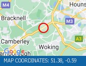
CLEARED @ 22:29Location:
M3, 2.51m of
Egham,
Surrey
Street View M3 camera (Streetview):
Don't get stuck in traffic when you're out and about. Use our SMS service to get the latest traffic conditions instantly to your mobile phone.
M3 Eastbound - Accident×
 Accident
 Location : The M3 eastbound between junctions J4A (Farnborough) and J4 (Guildford) .
Lane Closures : Lanes 1 and 2 are closed.
Reason : Road traffic collision.
Status : Currently Active.
Time To Clear : The event is expected to clear between 01:45 and 02:00 on 28/04/2024.
Return To Normal : Normal traffic conditions are expected between 01:45 and 02:00 on 28/04/2024.
Lanes Closed : There are two of four lanes closed.
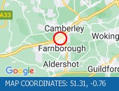
CLEARED @ 00:44Location:
M3, 3.52m of
Farnborough,
Hampshire
Street View M3 camera (Streetview):
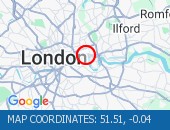
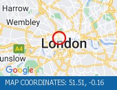
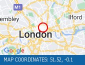
Ambrosden Avenue All Directions - Victoria Street (Westbou×
 Victoria Street (Westbound) b
 Victoria Street (Westbound) between Artillery Row and Bressenden Place. There will be a westbound closure to facilitate drainage works.
Location: Ambrosden Avenue, 0.34m of
Covent Garden,
Greater London
Street View Ambrosden Avenue camera (Streetview):
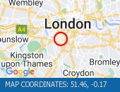
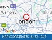
Limehouse Link All Directions - Limehouse Link Tunnel (We×
 Limehouse Link Tunnel (Westbou
 Limehouse Link Tunnel (Westbound) Lane one is blocked by a broken down vehicle. The vehicle has now been removed - all lanes are open.
Location: Limehouse Link, 0.56m of
Limehouse,
Greater London
Street View Limehouse Link camera (Streetview):
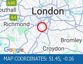
Limehouse Link Tunnel Both Directions - Limehouse Link Tunnel (Bo×
 Limehouse Link Tunnel (Both Di
 Limehouse Link Tunnel (Both Directions) - Closure overnight to facilitate works
Location: Limehouse Link Tunnel, 0.47m of
Limehouse,
Greater London
Street View Limehouse Link Tunnel camera (Streetview):
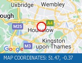
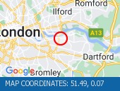
Bishopsford Road All Directions - Middleton Road (Both Dire×
 Middleton Road (Both Direction
 Middleton Road (Both Directions) between Bishopsford Road and St Helier Avenue - road closure to facilitate carriageway resurfacing. Local diversion in place.
Location: Bishopsford Road, 1.47m of
Camberwell,
Greater London
Street View Bishopsford Road camera (Streetview):
Eatonville Road All Directions - Trinity Road (Both Direct×
 Trinity Road (Both Directions)
 Trinity Road (Both Directions) at the junction of Eatonville Road - Temporary traffic signals will be in place to facilitate water works.
Location: Eatonville Road, 1.51m of
Balham,
Greater London
Street View Eatonville Road camera (Streetview):
Trojan Way All Directions - Purley Way (Northbound) b×
 Purley Way (Northbound) betwee
 Purley Way (Northbound) between Whitestone Way and Commerce Way - Lane restrictions to facilitate carriageway chamber access works for new connections. (Night works only)
Location: Trojan Way, 1.11m of
Croydon,
Greater London
Street View Trojan Way camera (Streetview):
Crittalls Corner All Directions - Sidcup By-pass Road (East×
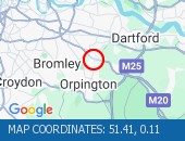 Sidcup By-pass Road (Eastbound
 Sidcup By-pass Road (Eastbound) at the junction of Crittlls Corner - The A20 will be closed between Crittalls Corner and the M25 J3 for overnight works.
Location: Crittalls Corner, 0.31m of
Sidcup,
Greater London
Street View Crittalls Corner camera (Streetview):
Longlands Road All Directions - Station Road (All Directi×
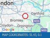 Station Road (All Directions)a
 Station Road (All Directions)at the junction of Longlands Road will have various road closures in place for the duration of the works.
Location: Longlands Road, 1.32m of
Sidcup,
Greater London
Street View Longlands Road camera (Streetview):
Stainer Street All Directions - Tooley Street (Both Direc×
 Tooley Street (Both Directions
 Tooley Street (Both Directions) at the junction of Stainer Street - Temporary signals in operation to facilitate works by Colt.
Location: Stainer Street, 0.29m of
Finsbury,
Greater London
Street View Stainer Street camera (Streetview):
Leonard Street All Directions - City Road (All Directions×
 City Road (All Directions) at
 City Road (All Directions) at the junction of Leonard Street - Temporary traffic signals in operation to facilitate road works. No restrictions in place - Traffic light and flowing well
Location: Leonard Street, 0.64m of
Shoreditch,
Greater London
Street View Leonard Street camera (Streetview):
Limehouse Link Tunnel East Bound - Limehouse Link Tunnel (Ea×
Limehouse Link Tunnel (Eastbou Limehouse Link Tunnel (Eastbound) - lane one blocked due to broken down car. Vehicle has now been recovered. All lanes now reopen. Traffic flowing well.
Location: Limehouse Link Tunnel, 0.56m of
Limehouse,
Greater London
Street View Limehouse Link Tunnel camera (Streetview):
Dupree Road All Directions - Hardman Road (All Directi×
 Hardman Road (All Directions)
 Hardman Road (All Directions) at the junction of Dupree Road - Lane restrictions to facilitate roadworks All restrictions have been removed - Traffic flows have returned to normal
Location: Dupree Road, 1.03m of
Cubitt Town,
Greater London
Street View Dupree Road camera (Streetview):
Stoke Newington Church Street All Direct - Stoke Newington High Stre×
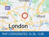 Stoke Newington High Street (B
 Stoke Newington High Street (Both Directions) at the junction of Stoke Newington Church Street. Traffic lights are working. Traffic signals are on and working. Traffic is moving well.
Location: Stoke Newington Church Street, 0.48m of
Stoke Newington,
Greater London
Street View Stoke Newington Church Street camera (Streetview):
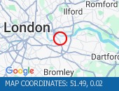
Crownfield Road All Directions - Crownfield Road (All Dire×
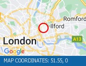 Crownfield Road (All Direction
 Crownfield Road (All Directions) at the junction of A112 Leyton High Road - Temporary signals in operation due to bus shelter upgrade works. (Sundays Only)
Location: Crownfield Road, 1.29m of
Stratford,
Greater London
Street View Crownfield Road camera (Streetview):
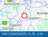
Purley Downs Road All Directions - Sanderstead Hill (Both Di×
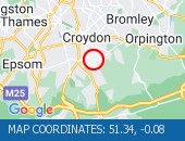 Sanderstead Hill (Both Directi
 Sanderstead Hill (Both Directions) at the junction of Sundown Avenue - Possible lane closures because of a collision. The road has reopened.
Location: Purley Downs Road, 3.04m of
Carshalton,
Greater London
Street View Purley Downs Road camera (Streetview):
Alexandra Road All Directions - Lampton Road (Both Direct×
 Lampton Road (Both Directions)
 Lampton Road (Both Directions) at the junction of Alexandra Road - Temporary signals in operation to facilitate resurfacing works.
Location: Alexandra Road, 0.84m of
Hounslow,
Greater London
Street View Alexandra Road camera (Streetview):
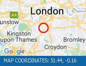
Bolingbroke Grove All Directions - Nightingale Lane (Both Di×
 Nightingale Lane (Both Directi
 Nightingale Lane (Both Directions) between Bolingbroke Grove and Balham Hill - road closed to facilitate carriageway resurfacing. Expect delays on approach.
Location: Bolingbroke Grove, 1.3m of
Balham,
Greater London
Street View Bolingbroke Grove camera (Streetview):
St John's Road All Directions - Battersea Rise (Eastbound×
 Battersea Rise (Eastbound) at
 Battersea Rise (Eastbound) at the junction of St John's Road - Lane one closure in place to remove and build a bus shelter.
Location: St John's Road, 1.44m of
Camden Town,
Greater London
Street View St John's Road camera (Streetview):
Marble Arch All Directions - Oxford Street (Eastbound)×
 Oxford Street (Eastbound) at t
 Oxford Street (Eastbound) at the junction of Marble Arch - lane closure to facilitate bus shelter maintenance.
Location: Marble Arch, 1m of
Marylebone,
Greater London
Street View Marble Arch camera (Streetview):
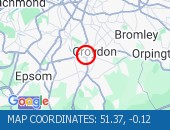
Crown Lane All Directions - Bromley Common (Southboun×
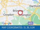 Bromley Common (Southbound) at
 Bromley Common (Southbound) at the junction of Crown Lane - There is a collision at this location. The southbound carriageway is blocked due a collision. Police are directing traffic. Expect delays
Location: Crown Lane, 0.91m of
Bromley,
Greater London
Street View Crown Lane camera (Streetview):
Bedford Hill All Directions - Balham Station Road (Both×
 Balham Station Road (Both Dire
 Balham Station Road (Both Directions) between Bedford Hill and Balham High Road - Road closed to facilitate carriageway resurfacing. Use other routes.
Location: Bedford Hill, 0.88m of
Balham,
Greater London
Street View Bedford Hill camera (Streetview):
Leathwell Road All Directions - Thurston Road (Both Direc×
 Thurston Road (Both Directions
 Thurston Road (Both Directions) at the junction of Leathwell Road - The road will be closed overnight to facilitate bridge maintenance works.
Location: Leathwell Road, 0.76m of
Greenwich,
Greater London
Street View Leathwell Road camera (Streetview):
Oxford Street All Directions - Oxford Street junction wi×
 Oxford Street junction with Da
 Oxford Street junction with Davies Street - Single alternate lane traffic controlled by STOP / GO boards or temporary traffic signals to facilitate works Works take place overnight between 2200-0600hrs. Delays possible between these times.
Location: Oxford Street, 0.99m of
Marylebone,
Greater London
Street View Oxford Street camera (Streetview):
East Poultry Avenue All Directions - Charterhouse Street (Both×
 Charterhouse Street (Both Dire
 Charterhouse Street (Both Directions) between St John Street and East Poultry Avenue - full closure due to crane operation on weekends only. Drivers are advised to use an alternative route when closures are in place. Road remains open at present.
Location: East Poultry Avenue, 0.61m of
Bloomsbury,
Greater London
Street View East Poultry Avenue camera (Streetview):
Macbean Street All Directions - Beresford Street (Both Di×
 Beresford Street (Both Directi
 Beresford Street (Both Directions) at the junction of Macbean Street - One lane closed to facilitate the creation of a new road junction for a hotel complex. Lane one (of two) closure in place. Traffic is moving well on approach.
Location: Macbean Street, 2.9m of
Cubitt Town,
Greater London
Street View Macbean Street camera (Streetview):
Argyle Street All Directions - Euston Road (Westbound) a×
 Euston Road (Westbound) at the
 Euston Road (Westbound) at the junction of Argyle Street - Lane one closed overnight to facilitate subway works.
Location: Argyle Street, 0.96m of
Bloomsbury,
Greater London
Street View Argyle Street camera (Streetview):
Crestfield Street All Directions - Euston Road (Eastbound) a×
Euston Road (Eastbound) at the Euston Road (Eastbound) at the junction of Crestfield Street - Lane one closed overnight outside Kings Cross station to facilitate pavement works.
Location: Crestfield Street, 0.98m of
Bloomsbury,
Greater London
Street View Crestfield Street camera (Streetview):
Angel Road (North Circular Road) All Dir - Angel Road (North Circula×
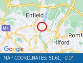 Angel Road (North Circular Roa
 Angel Road (North Circular Road) (All Directions) at the junction of the Cooks Ferry Flyover - The A406 has been fully reopened eastbound with one lane reopened in the westbound carriageway. All lanes open with traffic flowing well.
Location: Angel Road (North Circular Road), 0.92m of
Walthamstow,
Greater London
Street View Angel Road (North Circular Road) camera (Streetview):
Station Parade All Directions - Southgate Circus junction×
 Southgate Circus junction with
 Southgate Circus junction with Chase Side(All Directions) There is a collision at this location. Traffic is flowing well.
Location: Station Parade, 1.63m of
Palmers Green,
Greater London
Street View Station Parade camera (Streetview):
Wheatlands All Directions - Heston Road (All Directio×
 Heston Road (All Directions) a
 Heston Road (All Directions) at the junction of Wheatlands - Temporary signals in operation to facilitate resurfacing works. Expect some delays while the restrictions are in place.
Location: Wheatlands, 1.71m of
Hounslow,
Greater London
Street View Wheatlands camera (Streetview):
Campden Hill Road All Directions - Notting Hill Gate (Westbo×
 Notting Hill Gate (Westbound)
 Notting Hill Gate (Westbound) at the junction of Campden Hill Road. Road closure following a collision. Notting Hill Gate westbound has reopened following the earlier road trafic collision. Traffic is flowing well in the area.
Location: Campden Hill Road, 0.92m of
Paddington,
Greater London
Street View Campden Hill Road camera (Streetview):
Drury Crescent All Directions - Purley Way (Northbound) b×
Purley Way (Northbound) betwee Purley Way (Northbound) between Whitestone Way and Commerce Way - Lane closure for BT works.
Location: Drury Crescent, 0.99m of
Croydon,
Greater London
Street View Drury Crescent camera (Streetview):
Oldstead Road All Directions - Bromley Road (All Directi×
 Bromley Road (All Directions)
 Bromley Road (All Directions) at the junction of Beckenham Hill Road - Temporary Traffic Signals in operation to facilitate works
Location: Oldstead Road, 1.59m of
Lewisham,
Greater London
Street View Oldstead Road camera (Streetview):
 Highways Agency
 The AA
 Traffic Cymru
 Traffic Scotland
 YOUR AD HERE